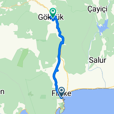
Lykien Tag 5
A cycling route starting in Finike, Antalya Province, Turkey.
Overview
About this route
- -:--
- Duration
- 44.4 km
- Distance
- 254 m
- Ascent
- 229 m
- Descent
- ---
- Avg. speed
- ---
- Avg. speed
Continue with Bikemap
Use, edit, or download this cycling route
You would like to ride Lykien Tag 5 or customize it for your own trip? Here is what you can do with this Bikemap route:
Free features
- Save this route as favorite or in collections
- Copy & plan your own version of this route
- Sync your route with Garmin or Wahoo
Premium features
Free trial for 3 days, or one-time payment. More about Bikemap Premium.
- Navigate this route on iOS & Android
- Export a GPX / KML file of this route
- Create your custom printout (try it for free)
- Download this route for offline navigation
Discover more Premium features.
Get Bikemap PremiumFrom our community
Other popular routes starting in Finike
- Finike-Kemer
- Distance
- 72.3 km
- Ascent
- 750 m
- Descent
- 740 m
- Location
- Finike, Antalya Province, Turkey
- Lykien Tag 5
- Distance
- 44.4 km
- Ascent
- 254 m
- Descent
- 229 m
- Location
- Finike, Antalya Province, Turkey
- Finike-Kas
- Distance
- 75.5 km
- Ascent
- 1,023 m
- Descent
- 863 m
- Location
- Finike, Antalya Province, Turkey
- От Akdeniz Bulvarı, Finike до Akdeniz Bulvarı, Finike
- Distance
- 7.3 km
- Ascent
- 0 m
- Descent
- 3 m
- Location
- Finike, Antalya Province, Turkey
- Finike Çirali por la costa
- Distance
- 48.7 km
- Ascent
- 520 m
- Descent
- 519 m
- Location
- Finike, Antalya Province, Turkey
- Olympos (fr.Fin.)
- Distance
- 48.4 km
- Ascent
- 763 m
- Descent
- 752 m
- Location
- Finike, Antalya Province, Turkey
- От Finike-Demre Yolu, Finike до Finike-Demre Yolu, Demre
- Distance
- 9 km
- Ascent
- 33 m
- Descent
- 70 m
- Location
- Finike, Antalya Province, Turkey
- 2. Südküste (Finike- Cavus)
- Distance
- 45.1 km
- Ascent
- 454 m
- Descent
- 459 m
- Location
- Finike, Antalya Province, Turkey
Open it in the app