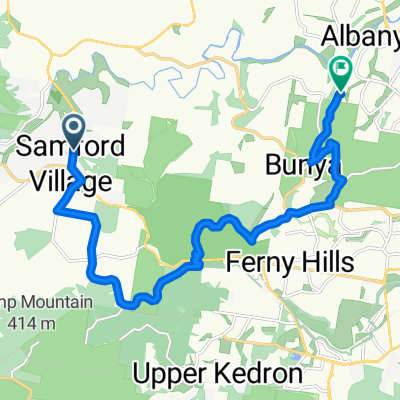
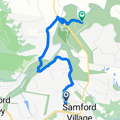
Kedron Brook Bikeway - Nudgee Beach
A cycling route starting in Samford Valley, Queensland, Australia.
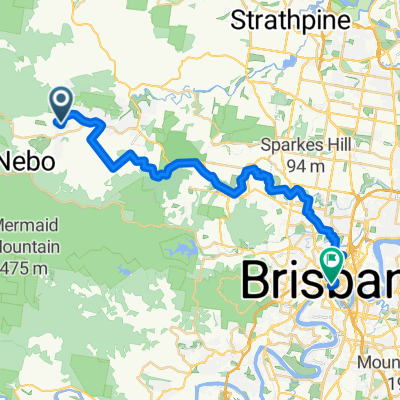
Overview
About this route
- -:--
- Duration
- 74.7 km
- Distance
- 678 m
- Ascent
- 679 m
- Descent
- ---
- Avg. speed
- 160 m
- Avg. speed
Route quality
Waytypes & surfaces along the route
Waytypes
Cycleway
34.3 km
(46 %)
Busy road
17.8 km
(24 %)
Surfaces
Paved
65.3 km
(87 %)
Unpaved
0.3 km
(<1 %)
Concrete
24.5 km
(33 %)
Asphalt
22.9 km
(31 %)
Route highlights
Points of interest along the route
Point of interest after 13.5 km
Get onto the bikeway here, near Brookside Shopping Centre.
Point of interest after 15.5 km
Check out the Flying Fox colony in the trees straight ahead.
Point of interest after 23.1 km
Watch for cars when crossing the road.
Point of interest after 25.1 km
Watch for cars when crossing the road.
Point of interest after 26 km
If you have time, do a couple of laps of the criterium track.
Point of interest after 32.6 km
Nudgee Road, ride along the pathway or the road.
Point of interest after 35.7 km
Stop here for a break in the car park and admire the ocean view.
Point of interest after 41.9 km
Pause for another break before heading for home.
Point of interest after 45.1 km
Back onto roads again.
Continue with Bikemap
Use, edit, or download this cycling route
You would like to ride Kedron Brook Bikeway - Nudgee Beach or customize it for your own trip? Here is what you can do with this Bikemap route:
Free features
- Save this route as favorite or in collections
- Copy & plan your own version of this route
- Sync your route with Garmin or Wahoo
Premium features
Free trial for 3 days, or one-time payment. More about Bikemap Premium.
- Navigate this route on iOS & Android
- Export a GPX / KML file of this route
- Create your custom printout (try it for free)
- Download this route for offline navigation
Discover more Premium features.
Get Bikemap PremiumFrom our community
Other popular routes starting in Samford Valley
- Hills District - Strathpine - Lilley Rd
- Distance
- 44.5 km
- Ascent
- 413 m
- Descent
- 413 m
- Location
- Samford Valley, Queensland, Australia
- Winn Rd Hills District circuit
- Distance
- 46.8 km
- Ascent
- 386 m
- Descent
- 372 m
- Location
- Samford Valley, Queensland, Australia
- Samford - Kobble Ck
- Distance
- 50.7 km
- Ascent
- 467 m
- Descent
- 455 m
- Location
- Samford Valley, Queensland, Australia
- Cedar Creek - Original
- Distance
- 30.5 km
- Ascent
- 380 m
- Descent
- 378 m
- Location
- Samford Valley, Queensland, Australia
- Bunya - Albany Creek - Cashmere
- Distance
- 51.3 km
- Ascent
- 536 m
- Descent
- 519 m
- Location
- Samford Valley, Queensland, Australia
- Dayboro - Mt Pleasant
- Distance
- 70.5 km
- Ascent
- 585 m
- Descent
- 573 m
- Location
- Samford Valley, Queensland, Australia
- Sandgate via Jinker
- Distance
- 60.1 km
- Ascent
- 340 m
- Descent
- 338 m
- Location
- Samford Valley, Queensland, Australia
- Tour de Hills
- Distance
- 35.1 km
- Ascent
- 550 m
- Descent
- 547 m
- Location
- Samford Valley, Queensland, Australia
Open it in the app