

Østmarka 100K
A cycling route starting in Kolbotn, Akershus, Norway.
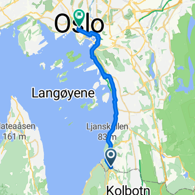
Overview
About this route
På krys og tvers for å få nok på en dag
- -:--
- Duration
- 111.6 km
- Distance
- 1,996 m
- Ascent
- 1,914 m
- Descent
- ---
- Avg. speed
- 324 m
- Max. altitude

Continue with Bikemap
Use, edit, or download this cycling route
You would like to ride Østmarka 100K or customize it for your own trip? Here is what you can do with this Bikemap route:
Free features
- Save this route as favorite or in collections
- Copy & plan your own version of this route
- Split it into stages to create a multi-day tour
- Sync your route with Garmin or Wahoo
Premium features
Free trial for 3 days, or one-time payment. More about Bikemap Premium.
- Navigate this route on iOS & Android
- Export a GPX / KML file of this route
- Create your custom printout (try it for free)
- Download this route for offline navigation
Discover more Premium features.
Get Bikemap PremiumFrom our community
Other popular routes starting in Kolbotn
 From Oslo to Ås
- Distance
- 30.4 km
- Ascent
- 532 m
- Descent
- 570 m
- Location
- Kolbotn, Akershus, Norway
 From Trollåsen to Oslo
- Distance
- 13.6 km
- Ascent
- 231 m
- Descent
- 269 m
- Location
- Kolbotn, Akershus, Norway
 Nøklevann
- Distance
- 20.8 km
- Ascent
- 250 m
- Descent
- 167 m
- Location
- Kolbotn, Akershus, Norway
 oslo bos 8km
- Distance
- 8.2 km
- Ascent
- 153 m
- Descent
- 147 m
- Location
- Kolbotn, Akershus, Norway
 Østmarka 100K
- Distance
- 111.6 km
- Ascent
- 1,996 m
- Descent
- 1,914 m
- Location
- Kolbotn, Akershus, Norway
 Enebakk rundt CLONED FROM ROUTE 166786
- Distance
- 81.5 km
- Ascent
- 430 m
- Descent
- 427 m
- Location
- Kolbotn, Akershus, Norway
 Nedenom og Hjem
- Distance
- 12.8 km
- Ascent
- 221 m
- Descent
- 221 m
- Location
- Kolbotn, Akershus, Norway
 Austmarka rundt
- Distance
- 81.1 km
- Ascent
- 446 m
- Descent
- 446 m
- Location
- Kolbotn, Akershus, Norway
Open it in the app