
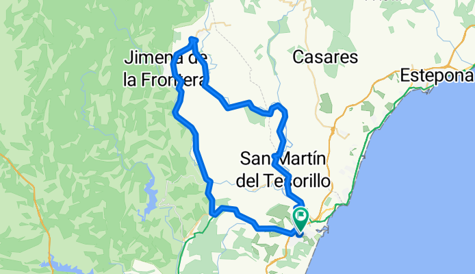
Sotogrande San Martin del Tesorillo, San Pablo de Buceite Jimena Sotogrande via Soto Alta
A cycling route starting in San Roque, Andalusia, Spain.
Overview
About this route
- -:--
- Duration
- 66.3 km
- Distance
- 334 m
- Ascent
- 342 m
- Descent
- ---
- Avg. speed
- ---
- Max. altitude
Route quality
Waytypes & surfaces along the route
Waytypes
Road
4 km
(6 %)
Quiet road
2 km
(3 %)
Surfaces
Paved
9.9 km
(15 %)
Unpaved
1.3 km
(2 %)
Asphalt
9.9 km
(15 %)
Gravel
1.3 km
(2 %)
Undefined
55 km
(83 %)
Continue with Bikemap
Use, edit, or download this cycling route
You would like to ride Sotogrande San Martin del Tesorillo, San Pablo de Buceite Jimena Sotogrande via Soto Alta or customize it for your own trip? Here is what you can do with this Bikemap route:
Free features
- Save this route as favorite or in collections
- Copy & plan your own version of this route
- Sync your route with Garmin or Wahoo
Premium features
Free trial for 3 days, or one-time payment. More about Bikemap Premium.
- Navigate this route on iOS & Android
- Export a GPX / KML file of this route
- Create your custom printout (try it for free)
- Download this route for offline navigation
Discover more Premium features.
Get Bikemap PremiumFrom our community
Other popular routes starting in San Roque
 8. Taraguilla - Tarifa - Conil de la Frontera
- Distance
- 116.8 km
- Ascent
- 879 m
- Descent
- 848 m
- Location
- San Roque, Andalusia, Spain
 Recorded via Apple Watch - 31/07/2021, 19:17
- Distance
- 10.4 km
- Ascent
- 0 m
- Descent
- 0 m
- Location
- San Roque, Andalusia, Spain
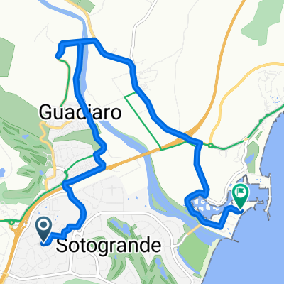
 Sotogrande-Pinar del Rey
- Distance
- 37.7 km
- Ascent
- 439 m
- Descent
- 436 m
- Location
- San Roque, Andalusia, Spain
 Ronda2012-3-125
- Distance
- 125.6 km
- Ascent
- 2,054 m
- Descent
- 1,331 m
- Location
- San Roque, Andalusia, Spain
 ronda12-3
- Distance
- 124.5 km
- Ascent
- 2,385 m
- Descent
- 1,666 m
- Location
- San Roque, Andalusia, Spain
 Sotogrande San Martin del Tesorillo, San Pablo de Buceite Jimena Sotogrande via Soto Alta
- Distance
- 66.3 km
- Ascent
- 334 m
- Descent
- 342 m
- Location
- San Roque, Andalusia, Spain
 20-01-06 La Línea de la concepción
- Distance
- 18 km
- Ascent
- 23 m
- Descent
- 108 m
- Location
- San Roque, Andalusia, Spain
 Alcaidesa - Tarifa Hin und Rück
- Distance
- 45.3 km
- Ascent
- 596 m
- Descent
- 612 m
- Location
- San Roque, Andalusia, Spain
Open it in the app