

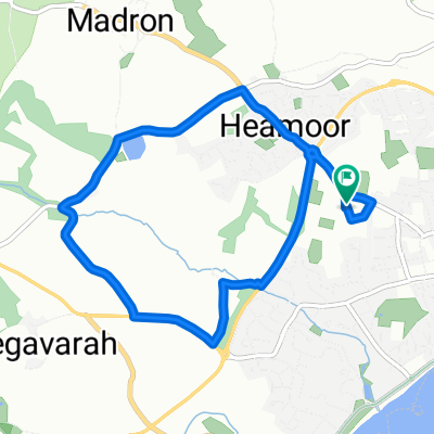
Penzance Train Stationto Land End YHA
A cycling route starting in Penzance, England, United Kingdom.
Overview
About this route
start of lejog, route from train station to YHA, prestart!
8.38 mile
- -:--
- Duration
- 13.5 km
- Distance
- 212 m
- Ascent
- 141 m
- Descent
- ---
- Avg. speed
- ---
- Max. altitude
Route quality
Waytypes & surfaces along the route
Waytypes
Road
2.2 km
(16 %)
Quiet road
1.3 km
(10 %)
Surfaces
Paved
4.9 km
(36 %)
Asphalt
4.9 km
(36 %)
Undefined
8.6 km
(64 %)
Continue with Bikemap
Use, edit, or download this cycling route
You would like to ride Penzance Train Stationto Land End YHA or customize it for your own trip? Here is what you can do with this Bikemap route:
Free features
- Save this route as favorite or in collections
- Copy & plan your own version of this route
- Sync your route with Garmin or Wahoo
Premium features
Free trial for 3 days, or one-time payment. More about Bikemap Premium.
- Navigate this route on iOS & Android
- Export a GPX / KML file of this route
- Create your custom printout (try it for free)
- Download this route for offline navigation
Discover more Premium features.
Get Bikemap PremiumFrom our community
Other popular routes starting in Penzance
 Penzance Train Stationto Land End YHA
- Distance
- 13.5 km
- Ascent
- 212 m
- Descent
- 141 m
- Location
- Penzance, England, United Kingdom
 PZ Tri run route
- Distance
- 6.4 km
- Ascent
- 71 m
- Descent
- 70 m
- Location
- Penzance, England, United Kingdom
 Cruciate
- Distance
- 429.8 km
- Ascent
- 1,439 m
- Descent
- 1,272 m
- Location
- Penzance, England, United Kingdom
 Lejog 04 - 01: Penzance - Lands End - Penzance - Golant YH
- Distance
- 116.7 km
- Ascent
- 842 m
- Descent
- 869 m
- Location
- Penzance, England, United Kingdom
 PZ Tri bike route
- Distance
- 27.1 km
- Ascent
- 292 m
- Descent
- 292 m
- Location
- Penzance, England, United Kingdom
 Penzance to St Just
- Distance
- 14.3 km
- Ascent
- 254 m
- Descent
- 141 m
- Location
- Penzance, England, United Kingdom
 Penzance - Sennen via Lamorna
- Distance
- 26.6 km
- Ascent
- 297 m
- Descent
- 301 m
- Location
- Penzance, England, United Kingdom
 Day 2 Penzance to Boscastle
- Distance
- 108 km
- Ascent
- 780 m
- Descent
- 533 m
- Location
- Penzance, England, United Kingdom
Open it in the app