
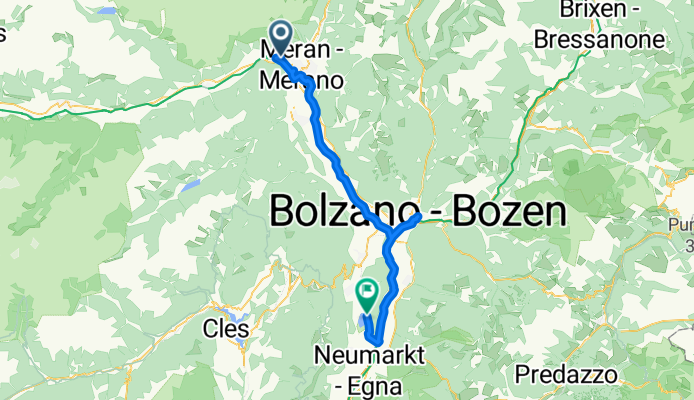
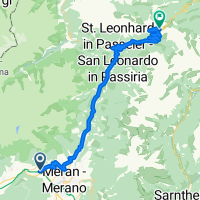
ET5.1: Algund--Meran--Bozen--EV7--Monte Gmund--Klughammer (Kalterer See)
A cycling route starting in Algund, Trentino-Alto Adige, Italy.
Overview
About this route
- 3 h 40 min
- Duration
- 61.5 km
- Distance
- 229 m
- Ascent
- 344 m
- Descent
- 16.8 km/h
- Avg. speed
- 351 m
- Max. altitude

Route quality
Waytypes & surfaces along the route
Waytypes
Cycleway
17.2 km
(28 %)
Path
8 km
(13 %)
Surfaces
Paved
28.9 km
(47 %)
Asphalt
28.9 km
(47 %)
Undefined
32.6 km
(53 %)
Continue with Bikemap
Use, edit, or download this cycling route
You would like to ride ET5.1: Algund--Meran--Bozen--EV7--Monte Gmund--Klughammer (Kalterer See) or customize it for your own trip? Here is what you can do with this Bikemap route:
Free features
- Save this route as favorite or in collections
- Copy & plan your own version of this route
- Sync your route with Garmin or Wahoo
Premium features
Free trial for 3 days, or one-time payment. More about Bikemap Premium.
- Navigate this route on iOS & Android
- Export a GPX / KML file of this route
- Create your custom printout (try it for free)
- Download this route for offline navigation
Discover more Premium features.
Get Bikemap PremiumFrom our community
Other popular routes starting in Algund
 Algund -Aschbach
- Distance
- 14.4 km
- Ascent
- 1,146 m
- Descent
- 122 m
- Location
- Algund, Trentino-Alto Adige, Italy
 Algund Falzeben 2
- Distance
- 19.7 km
- Ascent
- 1,355 m
- Descent
- 27 m
- Location
- Algund, Trentino-Alto Adige, Italy
 Hotel Vigiljoch
- Distance
- 37 km
- Ascent
- 1,523 m
- Descent
- 1,510 m
- Location
- Algund, Trentino-Alto Adige, Italy
 Allgund - Jaufenpass
- Distance
- 43 km
- Ascent
- 1,842 m
- Descent
- 146 m
- Location
- Algund, Trentino-Alto Adige, Italy
 Tuscia!
- Distance
- 1,299.3 km
- Ascent
- 4,116 m
- Descent
- 4,381 m
- Location
- Algund, Trentino-Alto Adige, Italy
 Algund - Schloss Tirol - Muthöfe
- Distance
- 13.4 km
- Ascent
- 1,099 m
- Descent
- 127 m
- Location
- Algund, Trentino-Alto Adige, Italy
 Mitterplars, Algund nach Lingweg 24, Dorf Tirol
- Distance
- 11.8 km
- Ascent
- 317 m
- Descent
- 197 m
- Location
- Algund, Trentino-Alto Adige, Italy
 Bergtour über Gampenjoch und Meldelpass
- Distance
- 102.7 km
- Ascent
- 1,751 m
- Descent
- 1,751 m
- Location
- Algund, Trentino-Alto Adige, Italy
Open it in the app