

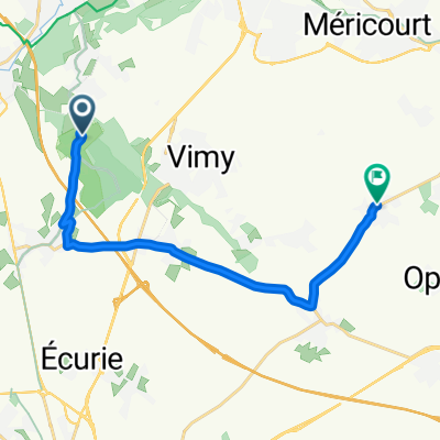
Arras - Vimy Ridge
A cycling route starting in Givenchy-en-Gohelle, Hauts-de-France, France.
Overview
About this route
- -:--
- Duration
- 17.9 km
- Distance
- 43 m
- Ascent
- 124 m
- Descent
- ---
- Avg. speed
- 151 m
- Max. altitude

Route quality
Waytypes & surfaces along the route
Waytypes
Busy road
5.4 km
(30 %)
Road
3.4 km
(19 %)
Surfaces
Paved
9.8 km
(55 %)
Unpaved
2.5 km
(14 %)
Asphalt
9.6 km
(54 %)
Unpaved (undefined)
2.1 km
(12 %)
Route highlights
Points of interest along the route
Point of interest after 0.6 km
Duitse Loopgraven
Continue with Bikemap
Use, edit, or download this cycling route
You would like to ride Arras - Vimy Ridge or customize it for your own trip? Here is what you can do with this Bikemap route:
Free features
- Save this route as favorite or in collections
- Copy & plan your own version of this route
- Sync your route with Garmin or Wahoo
Premium features
Free trial for 3 days, or one-time payment. More about Bikemap Premium.
- Navigate this route on iOS & Android
- Export a GPX / KML file of this route
- Create your custom printout (try it for free)
- Download this route for offline navigation
Discover more Premium features.
Get Bikemap PremiumFrom our community
Other popular routes starting in Givenchy-en-Gohelle
 2022 IEPER - ARRAS Deel 5
- Distance
- 17.1 km
- Ascent
- 105 m
- Descent
- 109 m
- Location
- Givenchy-en-Gohelle, Hauts-de-France, France
 pinchonvalles
- Distance
- 7.3 km
- Ascent
- 89 m
- Descent
- 86 m
- Location
- Givenchy-en-Gohelle, Hauts-de-France, France
 1 Chemin des Canadiens, Givenchy-en-Gohelle naar 6 Rue de Transloy, Lesbœufs
- Distance
- 57.9 km
- Ascent
- 1,554 m
- Descent
- 1,558 m
- Location
- Givenchy-en-Gohelle, Hauts-de-France, France
 Vimy
Vimy- Distance
- 17.5 km
- Ascent
- 139 m
- Descent
- 197 m
- Location
- Givenchy-en-Gohelle, Hauts-de-France, France
 De Chemin des Canadiens à D919
- Distance
- 12.9 km
- Ascent
- 21 m
- Descent
- 154 m
- Location
- Givenchy-en-Gohelle, Hauts-de-France, France
 2022 IEPER - ARRAS Deel 5
- Distance
- 13.1 km
- Ascent
- 103 m
- Descent
- 116 m
- Location
- Givenchy-en-Gohelle, Hauts-de-France, France
 Vimy Ridge-Arras
- Distance
- 15.2 km
- Ascent
- 65 m
- Descent
- 146 m
- Location
- Givenchy-en-Gohelle, Hauts-de-France, France
 De 16 Rue Isaïe Pruvost, Givenchy-en-Gohelle à 6 Rue de Soissons, Montigny-en-Gohelle
- Distance
- 15.7 km
- Ascent
- 42 m
- Descent
- 97 m
- Location
- Givenchy-en-Gohelle, Hauts-de-France, France
Open it in the app