

Zelena AVEntura
A cycling route starting in Lamovita, Republika Srpska, Bosnia and Herzegovina.
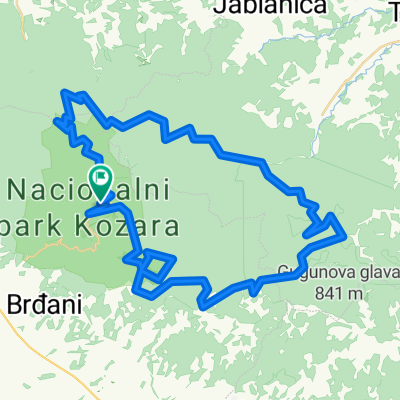
Overview
About this route
- 2 h 3 min
- Duration
- 34.8 km
- Distance
- 379 m
- Ascent
- 378 m
- Descent
- 17 km/h
- Avg. speed
- 247 m
- Max. altitude

Route quality
Waytypes & surfaces along the route
Waytypes
Quiet road
29.2 km
(84 %)
Road
3.8 km
(11 %)
Surfaces
Paved
15.9 km
(46 %)
Unpaved
9.5 km
(27 %)
Asphalt
15.8 km
(45 %)
Gravel
9 km
(26 %)
Route highlights
Points of interest along the route
Point of interest after 1.4 km
Ranjena ptica - simbol orla
Point of interest after 6.2 km
Fruit Organica, Donji Podragdci
Point of interest after 7.8 km
Putokaz za obližnje krčme
Point of interest after 8.9 km
Interpretacijska tabla u blizini Vrbaške, na temu Babića kule (poveznica u imenu)
Point of interest after 10.5 km
Kozara Sirevi, Donji Podgradci
Point of interest after 10.8 km
Krčma "Košuta", od 1972, možda mjesto za interpretacijsku tablu o rimskoj steli (okruženo grobljem)
Point of interest after 15.4 km
Putokaz za spomen-obilježja i crkvu Sv. Petra i Pavla u Grbavcima
Point of interest after 17.9 km
Izletište Lubina
Point of interest after 19.3 km
Kijevci (Manastirište), villa rustica i srednjovjekovne crkve
Point of interest after 23.1 km
Spomenici i crkva Sv. Petra i Pavla

Point of interest after 26.3 km
Interpretacijska tabla ? - prirodna baština (vidikovac s Potkozarja na Kozaru i Lijevče)

Point of interest after 29.5 km
Interpretacijska tabla na temu voćarske proizvodnje i Rimljana (postoji manifestacija Dani voća Potkozarja)
Continue with Bikemap
Use, edit, or download this cycling route
You would like to ride Zelena AVEntura or customize it for your own trip? Here is what you can do with this Bikemap route:
Free features
- Save this route as favorite or in collections
- Copy & plan your own version of this route
- Sync your route with Garmin or Wahoo
Premium features
Free trial for 3 days, or one-time payment. More about Bikemap Premium.
- Navigate this route on iOS & Android
- Export a GPX / KML file of this route
- Create your custom printout (try it for free)
- Download this route for offline navigation
Discover more Premium features.
Get Bikemap PremiumFrom our community
Other popular routes starting in Lamovita
 Kozarac - Trnopolje - Omarska
- Distance
- 18.3 km
- Ascent
- 196 m
- Descent
- 191 m
- Location
- Lamovita, Republika Srpska, Bosnia and Herzegovina
 prijedor - lisina 977m
- Distance
- 25.9 km
- Ascent
- 69 m
- Descent
- 880 m
- Location
- Lamovita, Republika Srpska, Bosnia and Herzegovina
 kozarski maraton
- Distance
- 64.7 km
- Ascent
- 1,600 m
- Descent
- 1,601 m
- Location
- Lamovita, Republika Srpska, Bosnia and Herzegovina
 Zelena AVEntura
- Distance
- 34.8 km
- Ascent
- 379 m
- Descent
- 378 m
- Location
- Lamovita, Republika Srpska, Bosnia and Herzegovina
 Tour 5
- Distance
- 85.3 km
- Ascent
- 646 m
- Descent
- 726 m
- Location
- Lamovita, Republika Srpska, Bosnia and Herzegovina
 Kozarac - Kozara
- Distance
- 12.1 km
- Ascent
- 707 m
- Descent
- 134 m
- Location
- Lamovita, Republika Srpska, Bosnia and Herzegovina
 Zelena aventura
- Distance
- 42.3 km
- Ascent
- 387 m
- Descent
- 397 m
- Location
- Lamovita, Republika Srpska, Bosnia and Herzegovina
 Sporty route
- Distance
- 5.3 km
- Ascent
- 62 m
- Descent
- 138 m
- Location
- Lamovita, Republika Srpska, Bosnia and Herzegovina
Open it in the app