

por la Reserva Nacional del Cijara (Badajoz)
A cycling route starting in Navalpino, Castille-La Mancha, Spain.
Overview
About this route
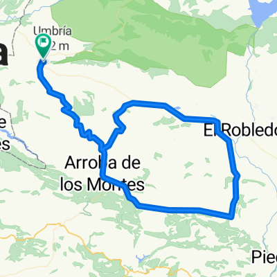
<p><strong>Route</strong>: Horcajo de los Montes - Cañada Real Segoviana - Puerto de Villarta - Forest Observatory La Rañuela - BA-7216 - El Arenal - Solana de las Burras - path to Collado del Azorejo - Solana del Azorejo - BA-7021 - Morro de Varela - Los Badenes - Majada Vieja - Azorejo de Helechosa - Morro de la Zoa - BA-7001 - Bohonal - path to Membrillar - path from Horcajo de los Montes to Bohonal - Horcajo de los Montes</p>
Translated, show original (Spanish)- -:--
- Duration
- 62.7 km
- Distance
- 927 m
- Ascent
- 927 m
- Descent
- ---
- Avg. speed
- ---
- Max. altitude

Continue with Bikemap
Use, edit, or download this cycling route
You would like to ride por la Reserva Nacional del Cijara (Badajoz) or customize it for your own trip? Here is what you can do with this Bikemap route:
Free features
- Save this route as favorite or in collections
- Copy & plan your own version of this route
- Sync your route with Garmin or Wahoo
Premium features
Free trial for 3 days, or one-time payment. More about Bikemap Premium.
- Navigate this route on iOS & Android
- Export a GPX / KML file of this route
- Create your custom printout (try it for free)
- Download this route for offline navigation
Discover more Premium features.
Get Bikemap PremiumFrom our community
Other popular routes starting in Navalpino
 Horcajo de los Montes y comarca
- Distance
- 118.8 km
- Ascent
- 957 m
- Descent
- 963 m
- Location
- Navalpino, Castille-La Mancha, Spain
 Navalpino - Los Valles
- Distance
- 34.3 km
- Ascent
- 788 m
- Descent
- 782 m
- Location
- Navalpino, Castille-La Mancha, Spain
 Cabañeros-Anchuras-La Jara
- Distance
- 50.4 km
- Ascent
- 657 m
- Descent
- 577 m
- Location
- Navalpino, Castille-La Mancha, Spain
 Piedraescrita
- Distance
- 147.8 km
- Ascent
- 1,373 m
- Descent
- 1,374 m
- Location
- Navalpino, Castille-La Mancha, Spain
 Horcajo de los Montes-Retuerta del Bullaque-Nava de Estenas
- Distance
- 118.5 km
- Ascent
- 1,315 m
- Descent
- 1,311 m
- Location
- Navalpino, Castille-La Mancha, Spain
 Horcajo circular - Cabañeros
- Distance
- 153.8 km
- Ascent
- 1,516 m
- Descent
- 1,516 m
- Location
- Navalpino, Castille-La Mancha, Spain
 Entre Cabañero y Cígara
- Distance
- 131.7 km
- Ascent
- 1,493 m
- Descent
- 1,517 m
- Location
- Navalpino, Castille-La Mancha, Spain
 por la Reserva Nacional del Cijara (Badajoz)
- Distance
- 62.7 km
- Ascent
- 927 m
- Descent
- 927 m
- Location
- Navalpino, Castille-La Mancha, Spain
Open it in the app