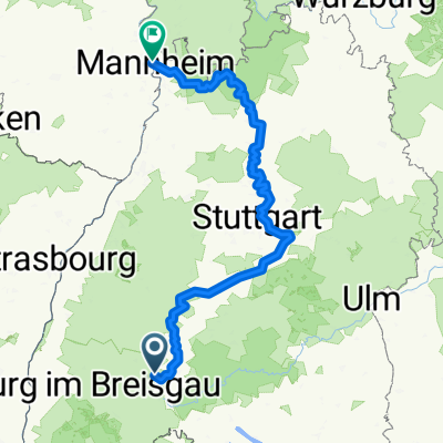
größere Trainingstour
- 34.5 km
- 515 m
- 482 m
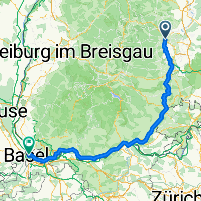
- Villingen-Schwenningen, Baden-Wurttemberg, Germany
A cycling route starting in Villingen-Schwenningen, Baden-Wurttemberg, Germany.
Overview
Varied route, however, strong winds are often to be expected.
created this 14 years ago
Route quality
Quiet road
158.8 km
(16 %)
Road
119.1 km
(12 %)
Paved
625.1 km
(63 %)
Unpaved
29.8 km
(3 %)
Asphalt
605.3 km
(61 %)
Paved (undefined)
9.9 km
(1 %)
Continue with Bikemap
You would like to ride von 78052 VS nach Le Boulou (F) or customize it for your own trip? Here is what you can do with this Bikemap route:
Free trial for 3 days, or one-time payment. More about Bikemap Premium.
Discover more Premium features.
Get Bikemap PremiumFrom our community
Open it in the app