

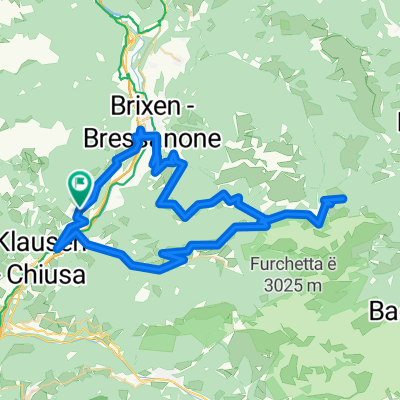
Königsetappe über Würzjoch und Grödner Joch
A cycling route starting in Feldthurns, Trentino-Alto Adige, Italy.
Overview
About this route
Auf dem steileren Weg über das Würzjoch nach Corvara und über die wunderschönen Kehren vom Grödner Joch zurück.
Mit über 3000 Hm und fast 120 Km die längste Etappe.
- -:--
- Duration
- 117.3 km
- Distance
- 2,786 m
- Ascent
- 2,784 m
- Descent
- ---
- Avg. speed
- ---
- Max. altitude

Route quality
Waytypes & surfaces along the route
Waytypes
Busy road
62 km
(53 %)
Road
18.8 km
(16 %)
Surfaces
Paved
82.8 km
(71 %)
Unpaved
10 km
(8 %)
Asphalt
81.6 km
(70 %)
Gravel
6 km
(5 %)
Continue with Bikemap
Use, edit, or download this cycling route
You would like to ride Königsetappe über Würzjoch und Grödner Joch or customize it for your own trip? Here is what you can do with this Bikemap route:
Free features
- Save this route as favorite or in collections
- Copy & plan your own version of this route
- Split it into stages to create a multi-day tour
- Sync your route with Garmin or Wahoo
Premium features
Free trial for 3 days, or one-time payment. More about Bikemap Premium.
- Navigate this route on iOS & Android
- Export a GPX / KML file of this route
- Create your custom printout (try it for free)
- Download this route for offline navigation
Discover more Premium features.
Get Bikemap PremiumFrom our community
Other popular routes starting in Feldthurns
 Seiseralmrunde
- Distance
- 72.3 km
- Ascent
- 2,062 m
- Descent
- 2,066 m
- Location
- Feldthurns, Trentino-Alto Adige, Italy
 Über Brixen zum Würzjoch - zurück über Klausen
- Distance
- 71.9 km
- Ascent
- 1,985 m
- Descent
- 1,983 m
- Location
- Feldthurns, Trentino-Alto Adige, Italy
 Königsetappe über Würzjoch und Grödner Joch
- Distance
- 117.3 km
- Ascent
- 2,786 m
- Descent
- 2,784 m
- Location
- Feldthurns, Trentino-Alto Adige, Italy
 Würzjoch - Runde
- Distance
- 66.8 km
- Ascent
- 2,021 m
- Descent
- 2,012 m
- Location
- Feldthurns, Trentino-Alto Adige, Italy
 Latzfonser-Kreuz-Runde
- Distance
- 73.3 km
- Ascent
- 2,687 m
- Descent
- 2,687 m
- Location
- Feldthurns, Trentino-Alto Adige, Italy
 Um die Sarntaler Alpen
- Distance
- 157.2 km
- Ascent
- 2,730 m
- Descent
- 3,135 m
- Location
- Feldthurns, Trentino-Alto Adige, Italy
 2014 Dolomiten Gesamt IST Track
- Distance
- 226 km
- Ascent
- 6,662 m
- Descent
- 6,662 m
- Location
- Feldthurns, Trentino-Alto Adige, Italy
 Day6: From Klausen to Lienz
- Distance
- 132.6 km
- Ascent
- 2,268 m
- Descent
- 2,738 m
- Location
- Feldthurns, Trentino-Alto Adige, Italy
Open it in the app