

Trarabias-Col de Banette
A cycling route starting in Saint-Ambroix, Occitanie, France.
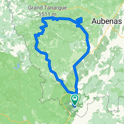
Overview
About this route
A loop beyond Bessèges:
- the Col du Grand Châtaignier (a must-ride);
- the climb to Tarabias;
- the ridges between the Luech valley and the Homol valley;
- then Vialas;
- the ascent to the Col de Banette with superb viewpoints;
- return via the ridge road (views of the Aigoual);
- the Luech valley;
- once again the Grand Châtaignier...
- -:--
- Duration
- 101.7 km
- Distance
- 1,161 m
- Ascent
- 1,161 m
- Descent
- ---
- Avg. speed
- ---
- Max. altitude

Route quality
Waytypes & surfaces along the route
Waytypes
Road
53.9 km
(53 %)
Quiet road
10.2 km
(10 %)
Undefined
37.6 km
(37 %)
Surfaces
Paved
19.3 km
(19 %)
Unpaved
2 km
(2 %)
Asphalt
19.3 km
(19 %)
Gravel
1 km
(1 %)
Continue with Bikemap
Use, edit, or download this cycling route
You would like to ride Trarabias-Col de Banette or customize it for your own trip? Here is what you can do with this Bikemap route:
Free features
- Save this route as favorite or in collections
- Copy & plan your own version of this route
- Split it into stages to create a multi-day tour
- Sync your route with Garmin or Wahoo
Premium features
Free trial for 3 days, or one-time payment. More about Bikemap Premium.
- Navigate this route on iOS & Android
- Export a GPX / KML file of this route
- Create your custom printout (try it for free)
- Download this route for offline navigation
Discover more Premium features.
Get Bikemap PremiumFrom our community
Other popular routes starting in Saint-Ambroix
 Cevennen-Tour 2007 Tag 8
- Distance
- 78.2 km
- Ascent
- 1,990 m
- Descent
- 1,822 m
- Location
- Saint-Ambroix, Occitanie, France
 road road road
- Distance
- 18.3 km
- Ascent
- 310 m
- Descent
- 312 m
- Location
- Saint-Ambroix, Occitanie, France
 Croix de Beauzon-col de Meyrand
- Distance
- 139.3 km
- Ascent
- 2,100 m
- Descent
- 2,100 m
- Location
- Saint-Ambroix, Occitanie, France
 route to saint ambroix
- Distance
- 19.6 km
- Ascent
- 201 m
- Descent
- 211 m
- Location
- Saint-Ambroix, Occitanie, France
 Finiels-Goulet
- Distance
- 172.8 km
- Ascent
- 2,569 m
- Descent
- 2,569 m
- Location
- Saint-Ambroix, Occitanie, France
 road up, trail down
- Distance
- 12.5 km
- Ascent
- 361 m
- Descent
- 367 m
- Location
- Saint-Ambroix, Occitanie, France
 Du bas Vivarais au Gerbier
- Distance
- 210.7 km
- Ascent
- 2,743 m
- Descent
- 2,743 m
- Location
- Saint-Ambroix, Occitanie, France
 Saint-Ambroix - Anduze
- Distance
- 48.4 km
- Ascent
- 266 m
- Descent
- 271 m
- Location
- Saint-Ambroix, Occitanie, France
Open it in the app