

New New Way of the Rings Day 10 Derby to Nuneaton
A cycling route starting in Derby, England, United Kingdom.
Overview
About this route
- -:--
- Duration
- 257.9 km
- Distance
- 2,039 m
- Ascent
- 1,993 m
- Descent
- ---
- Avg. speed
- 185 m
- Max. altitude

Route quality
Waytypes & surfaces along the route
Waytypes
Quiet road
149.6 km
(58 %)
Cycleway
38.7 km
(15 %)
Surfaces
Paved
80 km
(31 %)
Unpaved
15.5 km
(6 %)
Asphalt
64.5 km
(25 %)
Paved (undefined)
12.9 km
(5 %)
Route highlights
Points of interest along the route
Point of interest after 0 km
Bradbourne Stone Standing Stone in Derbyshire The Bradbourne Stone which Stands a couple of hundred metres north of Bradbourne Church at SK209530 where there is also a nice saxon cross shaft in churchyard. It is located behind a scrubby looking pond.
Point of interest after 0 km
Peat Well Holy Well / Spring in Derbyshire
Point of interest after 0 km
Alternative route via Derby
Point of interest after 0 km
Town Well submitted by Creative Commons Town WellHoly Well in Derbyshire. Tissington is known as the mother place of well dressing and visitors come from all over the world to witness the annual well dressing ceremony. This takes place on Ascension Day, when five attractive wells are dressed together with a children’s well. Well dressing is a custom found primarily in or near Derbyshire and, although the Church at one time banned the custom as water worship, the wells are often decorated with Christian themes. Well dressing is thought to go back to Pagan times, a ritual performed to give thanks for the supply of fresh water. Another school of thought claims that the Romans introduced the custom into Britain, the philosopher Seneca stating that – " where springs or rivers flow we should build altars or make sacrifices." Whatever the true origin, Tissington, recorded as dressing a well in 1349, is the oldest authenticated instance of well dressing in Derbyshire. It is probable that well dressing took place in 1350, in thanksgiving for the Tissington's escape from the Black Death, which was attributed to the purity of its water.
Point of interest after 0 km
Chambered Cairn in Derbyshire "Remains of a round cairn, possibly a chambered tomb comprising a circular mound incorporating megalithic "cist"-like chambers." - Pastscape monument no. 310779.
Point of interest after 0 km
Sited just under 200 metres north of the stone circle, The Northern Antiquarian (TNA) features a page for this cup marked stone - see their entry for Nine Stones Cup-Mark, Harthill, Derbyshire, which they record was found in 2009. TNA give directions for finding this stone, together with a photograph and a brief archaeology & history. Now to be found in a dry stone wall, TNA say: "Similar in size and form to the Bent Head cup-marked stone found in drystone walling near Todmorden, West Yorkshire, the proximity of the Nine Stone Close megalithic ring further up the slope from this example illustrated that prehistoric man found this location of some importance; but as the cup-markings — two definites, perhaps a third — had been etched onto a small portable rock, typical of those found in prehistoric tombs, we wondered whether or not a prehistoric grave had once stood close by. Thankfully, a persual of Barry Marsden’s (1977) catalogue later proved fruitful. For in the adjacent field below where this carved stone sits in its wall, at SK 2255 6286, there’s a scattered mass of loose rocks and smaller stones (akin to the one here with its cup-markings), which Marsden listed as a prehistoric tomb. It seems probable that this cup-marked ‘portable’ originally came from this much denuded burial spot."
Point of interest after 0 km
Stanton Moor Overlooking the gritstone moorlands to the east and south, Stanton Moor IV, although referred to as an embanked stone circle, is more reminiscent of a ring cairn. It is now completely covered in heather, but the egg-shaped ring of the embankment can be seen raised up above the ground and is approximately 12.5m by 13.5m internally in diameter. There appears to be one entrance to the south-west. A number of small stones survive on the site, including one in the entrance, two at the inner edge of the bank standing
Point of interest after 0 km
Dudwood Stone Circle in Derbyshire
Point of interest after 0 km
Arbor Low Henge Arbor Low according to English Heritage is a well-known and impressive prehistoric monument, sometimes referred to as ‘the Stonehenge of the North’, owing to its henge bank and ditch, stone circle and cove. It bears more of a passing resemblance (though on a smaller scale) to that other great Neolithic monument, Avebury, in Wiltshire. You put a small gift into a box in the farmyard wall - well worth a deviation from the Way of Rings route!
Point of interest after 0 km
Wirksworth Moor Standing Stone stone in Derbyshire Possible standing stone on Wirksworth Moor. There is some debate if it is a cattle scratching post, or a legit menhir. It is in a field opposite The Malt Shovel pub on the road from Wirksworth to Alderwasley.
Point of interest after 0 km
Kings Stone and Nine Ladies Stanton Moor is situated on elevated ground to the west of the River Derwent, near Bakewell in the Peak District. Few of the thousands of visitors who enjoy the tranquillity of the moor and the fine views can fail to notice the widespread archaeological remains that are dotted across this landscape. Most of these are thought to date from the Bronze Age, about 3,000 to 4,000 years ago. According to English Heritage; More than 70 stone cairns and barrows are known, and excavations over the past 100 years have demonstrated that many served as places of burial. The most evocative and well-known of these monuments is the Nine Ladies Stone Circle and the King Stone, set 40 metres (131 feet) to the west-south-west of the circle. Despite the name, there are 10 stones within the circle, the tenth (which has fallen and now lies flat) having been located in 1977. The stones are set on the inner edge of a slight bank, and form a ring which measures 11.5 x 10.5 metres (38 x 34 feet). The monument was first recorded by Major Hayman Rooke in 1782. He noted that there appeared to be stones in the centre of the ring, which may have formed a small cairn or ‘cist’. The names of the monuments derive from their associations with folk traditions, in which it is said that nine women were dancing on the Sabbath to a fiddler – the King Stone – and were turned to stone. The graffiti carved on the King Stone, which includes the name ‘Bill Stumps’, is also mentioned in The Pickwick Papers by Charles Dickens. In common with many other stone circles, little evidence has been uncovered to suggest why or when this stone circle was built and how it was used. Suggestions include a place for ceremony or burial, a territorial marker, a perceived link between the earth and the sky and the living and the dead, or a meeting place for seasonal events. Such monuments may have had many functions, their uses and perceived significance shifting over time.
Point of interest after 0 km
Horsedale Standing Stone Possible Standing Stone in Derbyshire
Point of interest after 0 km
Harborough Cave Rock Shelter in Derbyshire
Point of interest after 0 km
Minning Low is the largest and most prominently sited cairn in the Peak District, 2km to the west of Aldwark. Surrounded by a beech plantation 500m to the east of The High Peak Trail between the villages of Parwich and Elton, it is a landmark for miles around. Measuring 34m by 44m, the cairn consists of at least four chambers and has undergone a number of construction phases. The Low originally began life as a single chamber with a small mound comprised mainly of limestone probably during the Neolithic period. It was later covered by a long cairn with four chambers and later still converted into a massive circular mound, perhaps during the Bronze Age.
Point of interest after 0 km
Rains Cave No official access but getting onto Longcliffe Crags isn't really a problem. The cave entrance is at floor level in the large boulders centre of picture, the smaller stones are spoil from the cave excavations.
Point of interest after 0 km
Stand Low (Kniveton) Round Barrow(s) in Derbyshire The two barrows are found on a limestone ridge outcrop 270 metres at SK21335085 and 21325086 and are scheduled Ancient Monuments Number 13338. They are in Stanlow Nobbs field on Newhouse Farm, Kniveton, Derbyshire. Dimensions The largest mound to the North West is 16m by 13.5 m by 1-1.2m high. There is a smaller mound 20m to the South East which is 10.5m x 9.5m x 1m, this is generally believed to be natural. Archaeological History There is some confusion in the literature surrounding the sites known as Stan(d)low barrows. In total there appear to be three sites in Derbyshire. The other two being Standlow East of Dovedale SK15915358, and Stanlow SK16917923 near Little Hucklow
Point of interest after 0 km
St Oswald (Ashbourne) Ancient Cross in Derbyshire A fragment of the upper part of an Anglo Saxon cross in the interior of the church.
Point of interest after 0 km
The Brailsford Cross The Brailsford CrossThe Brailsford Cross, Derbyshire. In the churchyard of All Saints at Brailsford stands a Saxon/Norse cross, dating from 1000-40 AD. It has a sort of rounded bulbous shaft that tapers towards the top. Carved upon it a crude figure, probably a Viking warrior drawing his sword. Below that some Saxon interlacing. Weathering has, unfortunately, got to the lower part of the shaft. Apparently, the shaft was excavated from beneath a medieval cross. When its steps were dug up the pre-Conquest shaft was lying below that. The cross-shaft sits in a socketed base, near the porch, that is more recent in date. All Saints church houses a rather nice octagonal, Perpendicular font that has a Tudor rose carved on its base.
Point of interest after 11.2 km
Leave the bike tied up and walk for about 1 mile along the upper ridge above the River Trent. The Rock Shelter is atmospheric and well worth a visit!
Point of interest after 19.4 km
Moated Mound at Breedon-on-the-Hill submitted by ESgt Moated Mound at Breedon-on-the-HillArtificial Mound in Leicestershire and Rutland This site lies on the 46 degree solstice alignment of Castles and ancient sites which I discovered. It is on high ground, 115m, between the Bullwarks Hill Fort at Breedon-on-the-Hill and the ancient village in the Staunton Harold Estate. It is probably 5000 years old. Crop marks show large rectangular shapes adjacent. There are two more possible moated mounds nearby, like this one. The duck pond at Breedon Priory, and one in a corner of the golf course near he main road out of Breedon.
Point of interest after 19.6 km
Grace Dieu Priory Stone Standing Stone in Leicestershire and Rutland. This nearly 3' high squat stone lies in a field adjacent to and on the west side of the Grace Dieu Priory at Thringstone. It leans to the south and has a flat side aligned east-west. A notch in the top, possibly man-made, aligns north-south.
Point of interest after 44.5 km
Altar Stone, Whitwick submitted by enkidu41 Altar Stone, WhitwickNear Whitwick in Leicestershire, a so-called druidical 'Altar Stone' to the north-west of Mount Saint Bernard Abbey, the first monastery to be established in England after the Dissolution. It is a large flat stone resting on other smaller stones. This seems unlikely to have anything to do with prehistoric Druids but may be the work of late eighteenth century gentry who had a fascination with the highly-imaginary 'revival' of Druidism that was then fashionable.
Point of interest after 44.5 km
Cat Hill Wood Stone Stone Standing Stone - probably modern - in Leicestershire and Rutland. This stone in Cat Hill Wood is nearly 8' high and is the tallest standing stone in the county.
Point of interest after 44.5 km
Grey Hangman Stone submitted by enkidu41 Grey Hangman StoneStanding Stone in Leicestershire and Rutland. Located near Oaks in Charwood at at the edge of a small oak wood and due north of a small pond this 3' high stone stands in the shade of an oak tree. An inexplicable oval-shaped mound standing about a foot above the current field level surrounds both the stone and the tree. The mound may be made up of stones cleared from the field and may therefore obscure a further 1' or more of the stone.
Point of interest after 44.5 km
Cat Hill Wood Stone submitted by enkidu41 Cat Hill Wood StoneStanding Stone - probably modern - in Leicestershire and Rutland. This stone in Cat Hill Wood is nearly 8' high and is the tallest standing stone in the county. This does not appear to be ancient and may have been erected in the early part of the twentieth century by Boy Scouts from the nearby camp.
Point of interest after 44.5 km
Beacon Hill (Leicestershire) Beacon Hill (Leicestershire)Beacon Hill is a lovely country park in Leicestershire with spectacular rock formations and marvellous views. Less well known is the hill fort which is believed to be of Late Bronze Age date.
Point of interest after 44.5 km
Standing Stone in Leicestershire and Rutland. A recumbent stone nearly 3' long in the middle of a field to the immediate south-east of farm buildings.
Point of interest after 46.1 km
Bradgate Hunt's Hill Stone Standing Stone in Leicestershire. Although this 5 foot stone was certainly erected by humans Bob Trubshaw (see talk next month in Leicester) is of the opinion that it was a bunch of 20th century Boy Scouts! He doesn't elaborate on his reasons however. Situated just outside Bradgate Park in Leicestershire at Grid Ref SK524116, turn left at the public toilets and enter the wood to it's left. The stone stands right in the middle by a large Holly bush. Several recumbant stones surround the stone and there is a possible cist just to the west (other side of the bush).
Point of interest after 48.5 km
Standing Stone in Leicestershire and Rutland. This recumbent boulder of gritty sandstone is just under 3' long and lies to the western edge of the churchyard of St. Martin's Church in Desford.
Point of interest after 48.5 km
Huncote Stone StoneStanding Stone in Leicestershire and Rutland. This stone is at the roadside on the boundary of Huncote and Croft parishes. It was formerly embedded in a tree trunk and was removed and subsequently replaced (but possibly not in the exactly the same place) in about 1970 during road repair work.
Point of interest after 48.5 km
Stoney Stanton Standing Stone in Leicestershire and Rutland. A stone nearly 6' high and 3' wide standing at the entrance to an industrial unit. 3 faces are flat and 2 are vertical to form a right angle. It is probably modern and erected as a monument to the local massive quarries.
Point of interest after 50.5 km
King Richards's Well submitted by enkidu41 King Richards's WellHoly Well in Leicestershire and Rutland. King Richard's Well dates to 1813 and is, predictably, the place where Richard III is reputed to have drunk before the Battle of Bosworth. The present structure was restored or rebuilt in 1985.
Point of interest after 56.5 km
Wigstone Parva Henge in Leicestershire and Rutland. Cropmarks show triple concentric ring-ditches with the inner ring interrupted to provide a possible entrance. This is either a henge or possibly a causewayed barrow.
Point of interest after 60.2 km
Fenny Drayton Barrow submitted by gautrek Fenny Drayton BarrowRound Barrow in Leicestershire and Rutland A nice bowl barrow mound in a field. It is easy to get to as it just at the side of the road (which is the old Roman Mancetter road). It is about 25 metres in dia and 2.5 metres high. (Verified by MagicMap - Thorgrim)
Point of interest after 129.7 km
Anchor Church Cave or Rock Shelter in Derbyshire Four interconnected sandstone caves on a backwater previous portion of R.Trent. Said to have been the hermitage of St. Hardulph.
Point of interest after 129.7 km
St Wystan's (Repton) Early Christian Sculptured Stones & Saxon Crypt in Derbyshire St Wystan's, Repton is hugely significant, being the main home of the Mercian royal family for near 300 years. Due to the considerable spread of Mercia at the time, it is also arguably the site of a former capital of Great Britain, as we now have it. A near perfectly preserved Saxon Crypt is the main must-see attraction, with some fragments of Saxon stones in the porch, and some mounted on the walls. See the official Church Website for extensive details for everything you would need to know. It also has the tallest spire in South Derbyshire, and situated next to the noted school, it is hard to miss.
Point of interest after 257.9 km
Hampton Lucy Timber Circle Map Ref: SP252567 Landranger Map Number: 151 Latitude: 52.207951N Longitude: 1.632641W Condition: Destroyed Ambience: no data Access: no data Accuracy: 3
Point of interest after 257.9 km
wappenbury submitted by gautrek wappenburyA very nice hillfort with a village nestled inside its banks. It would appear that most of its banks are complete around 2 of its sides. It is visible from the various footpaths which cross this fort at various points. It also has a very nice church in the centre of the village.
Point of interest after 257.9 km
The route finishes at Chipping Norton but before reaching there are the The Rollright Stones - an ancient site located on the Oxfordshire & Warwickshire border in England. The complex consists of three main elements, The Kings Men stone circle, the King Stone, and the Whispering Knights
Point of interest after 257.9 km
Cursus destroyed - 3 in this vicinity
Point of interest after 257.9 km
Cat Hill Wood Stone submitted by enkidu41 Cat Hill Wood StoneStanding Stone - probably modern - in Leicestershire and Rutland. This stone in Cat Hill Wood is nearly 8' high and is the tallest standing stone in the county.
Point of interest after 257.9 km
St. John's Well (Warwickshire) submitted by HarryTwenty St. John's Well (Warwickshire)Holy Well or Sacred Spring in Warwickshire "St. Thomas in his edition of Dugdale (1730) inserted a long extract from an alleged court roll of 18 Henry VIII. It asserted that St John's Well was a place of Pilgrimage, 'St. John's bath' and 'our Ladys bath' being used respectively for the cleansing of male and female incontinent penitents. "There is still a slight issue of water from the indicated site, but only scattered fragments of masonry remain."
Point of interest after 257.9 km
Holy Well or Sacred Spring in Warwickshire Allegedly a baptismal holy well, this large bath-well is very easy to find, just down a slope outside the gate of the churchyard of St John the Baptist's, Berkswell. The water seems to flow southwards into the 16-foot square bath, though it's difficult to tell, and then enters a smaller bath to the south which has steps leading down into the water from either side. There's an inscription on the upper bath recording its restoration in 1851 (or perhaps 1831 - that's difficult to tell as well!). Of course the village takes its name from this spring - 'Berchewelle' in Domesday Book - though the meaning is obscure. The church seems to have had some ancient significance and may be a second-rank minster: it has a Norman crypt, very unusually for a village church, and John Leland reckoned that a St Milred (who may have been an 8th-century bishop of Worcester) was buried here. You may be viewing yesterday's version of this page. To see the most up to date information please register
Point of interest after 257.9 km
Ryton on Dunsmore Cursus Country: England County: Warwickshire Type: Cursus Nearest Town: Coventry Nearest Village: Ryton on Dunsmore Map Ref: SP404744 Landranger Map Number: 140 Latitude: 52.366169N Longitude: 1.408098W Condition: 3 Ambience: no data Access: no data Accuracy: 4
Point of interest after 257.9 km
Cruciform Long Enclosure in Warwickshire Status: Characteristic NMR No. SP 25 NE 17 Extent: 200mx28m Terminal type: Square Note: This location marks one terminal (end) of a cursus monument. The location of the other terminal can be found in the Nearby Site list below.
Continue with Bikemap
Use, edit, or download this cycling route
You would like to ride New New Way of the Rings Day 10 Derby to Nuneaton or customize it for your own trip? Here is what you can do with this Bikemap route:
Free features
- Save this route as favorite or in collections
- Copy & plan your own version of this route
- Split it into stages to create a multi-day tour
- Sync your route with Garmin or Wahoo
Premium features
Free trial for 3 days, or one-time payment. More about Bikemap Premium.
- Navigate this route on iOS & Android
- Export a GPX / KML file of this route
- Create your custom printout (try it for free)
- Download this route for offline navigation
Discover more Premium features.
Get Bikemap PremiumFrom our community
Other popular routes starting in Derby
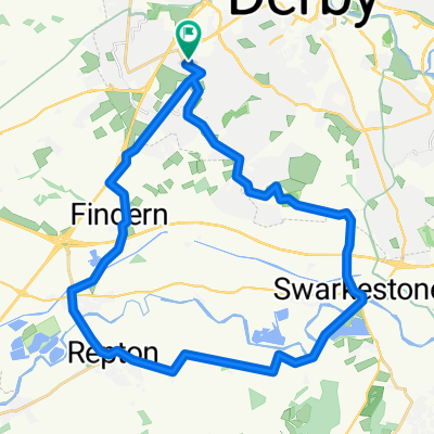
 Derby Circuit
- Distance
- 50.6 km
- Ascent
- 125 m
- Descent
- 126 m
- Location
- Derby, England, United Kingdom
 Saturday
- Distance
- 60.3 km
- Ascent
- 609 m
- Descent
- 610 m
- Location
- Derby, England, United Kingdom
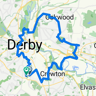
 Dean Close, Derby to Dean Close, Derby
- Distance
- 29.2 km
- Ascent
- 177 m
- Descent
- 180 m
- Location
- Derby, England, United Kingdom
 kedleston hall 11
- Distance
- 17.7 km
- Ascent
- 105 m
- Descent
- 108 m
- Location
- Derby, England, United Kingdom
 Route 1
- Distance
- 17 km
- Ascent
- 41 m
- Descent
- 52 m
- Location
- Derby, England, United Kingdom
 Balfour Road, Derby to Balfour Road, Derby
- Distance
- 25.3 km
- Ascent
- 149 m
- Descent
- 148 m
- Location
- Derby, England, United Kingdom
 New New Way of the Rings Day 10 Derby to Nuneaton
- Distance
- 257.9 km
- Ascent
- 2,039 m
- Descent
- 1,993 m
- Location
- Derby, England, United Kingdom
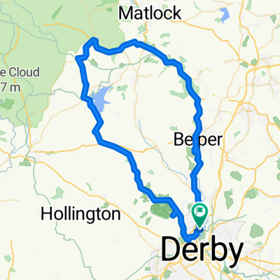 40 mile Tor,Brass,Carso,Ked
- Distance
- 64.8 km
- Ascent
- 506 m
- Descent
- 501 m
- Location
- Derby, England, United Kingdom
Open it in the app