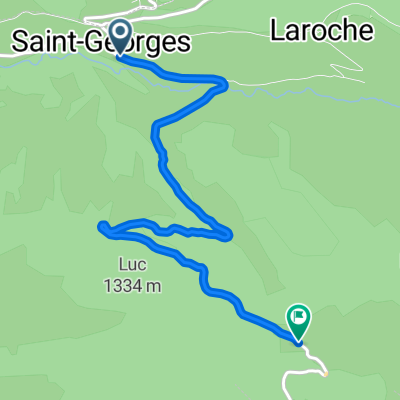
Cantal 2022 N掳5 133kms 2500D+
A cycling route starting in Saint-Cernin, Auvergne-Rh么ne-Alpes, France.
Overview
About this route
133kms (Barrages) Le falgoux >Tournemire en voiture, temps de d茅placement 45mn...tournemire - jussac - Crandelles - Lacapelle Viescamp - D18 - St 茅tienne Cantales - laroquebrou - D53 - Le Pont D'Orgon - Rodier - D2 - Barrage d'Enchanet - D 61 - vabre - Cavarnac - D 442 - Cambon Luest - D 53 - Parieu Haut - D 43 - Leygues - St Christophe des Gorges - Le Reynal - Loupiac - Sainte Eulalie - Le Chaumeil - D 37 - St MartinValmeroux - St Chamant - St Projet de Salers - D43 - Tournemeire
- -:--
- Duration
- 132.7 km
- Distance
- 2,871 m
- Ascent
- 2,873 m
- Descent
- ---
- Avg. speed
- 978 m
- Avg. speed
Route quality
Waytypes & surfaces along the route
Waytypes
Road
79 km
(60 %)
Busy road
31.1 km
(23 %)
Surfaces
Paved
49.5 km
(37 %)
Unpaved
0.4 km
(<1 %)
Asphalt
48.9 km
(37 %)
Paved (undefined)
0.6 km
(<1 %)
Continue with Bikemap
Use, edit, or download this cycling route
You would like to ride Cantal 2022 N掳5 133kms 2500D+ or customize it for your own trip? Here is what you can do with this Bikemap route:
Free features
- Save this route as favorite or in collections
- Copy & plan your own version of this route
- Sync your route with Garmin or Wahoo
Premium features
Free trial for 3 days, or one-time payment. More about Bikemap Premium.
- Navigate this route on iOS & Android
- Export a GPX / KML file of this route
- Create your custom printout (try it for free)
- Download this route for offline navigation
Discover more Premium features.
Get Bikemap PremiumFrom our community
Other popular routes starting in Saint-Cernin
- cantal tour (2)
- Distance
- 270.9 km
- Ascent
- 2,997 m
- Descent
- 3,015 m
- Location
- Saint-Cernin, Auvergne-Rh么ne-Alpes, France
- Col de Neronne
- Distance
- 67.5 km
- Ascent
- 1,296 m
- Descent
- 1,383 m
- Location
- Saint-Cernin, Auvergne-Rh么ne-Alpes, France
- Salers Puy Mary Salers
- Distance
- 69.2 km
- Ascent
- 1,338 m
- Descent
- 1,338 m
- Location
- Saint-Cernin, Auvergne-Rh么ne-Alpes, France
- L脡GAL, por Saint Georges
- Distance
- 5.7 km
- Ascent
- 468 m
- Descent
- 159 m
- Location
- Saint-Cernin, Auvergne-Rh么ne-Alpes, France
- De Salers 脿 Puy Mary 104, Le Claux
- Distance
- 19.6 km
- Ascent
- 928 m
- Descent
- 336 m
- Location
- Saint-Cernin, Auvergne-Rh么ne-Alpes, France
- les trois cols du cantal
- Distance
- 75.8 km
- Ascent
- 1,452 m
- Descent
- 1,452 m
- Location
- Saint-Cernin, Auvergne-Rh么ne-Alpes, France
- Cantal 2022 N掳5 133kms 2500D+
- Distance
- 132.7 km
- Ascent
- 2,871 m
- Descent
- 2,873 m
- Location
- Saint-Cernin, Auvergne-Rh么ne-Alpes, France
- Salers-Puy Mary-Salers
- Distance
- 62.8 km
- Ascent
- 1,396 m
- Descent
- 1,392 m
- Location
- Saint-Cernin, Auvergne-Rh么ne-Alpes, France
Open it in the app