

Millersylvannia State Park from Oly High School
A cycling route starting in Tenino, Washington, United States.
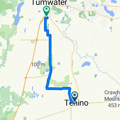
Overview
About this route
- -:--
- Duration
- 17.2 km
- Distance
- 186 m
- Ascent
- 209 m
- Descent
- ---
- Avg. speed
- 100 m
- Max. altitude

Route quality
Waytypes & surfaces along the route
Waytypes
Quiet road
6.5 km
(38 %)
Road
4.9 km
(29 %)
Surfaces
Paved
8.7 km
(51 %)
Unpaved
0.2 km
(1 %)
Asphalt
8.7 km
(51 %)
Ground
0.2 km
(1 %)
Undefined
8.2 km
(48 %)
Continue with Bikemap
Use, edit, or download this cycling route
You would like to ride Millersylvannia State Park from Oly High School or customize it for your own trip? Here is what you can do with this Bikemap route:
Free features
- Save this route as favorite or in collections
- Copy & plan your own version of this route
- Sync your route with Garmin or Wahoo
Premium features
Free trial for 3 days, or one-time payment. More about Bikemap Premium.
- Navigate this route on iOS & Android
- Export a GPX / KML file of this route
- Create your custom printout (try it for free)
- Download this route for offline navigation
Discover more Premium features.
Get Bikemap PremiumFrom our community
Other popular routes starting in Tenino
 POOP Day Two
- Distance
- 105.9 km
- Ascent
- 256 m
- Descent
- 325 m
- Location
- Tenino, Washington, United States
 Two County Double Metric Century
- Distance
- 201.8 km
- Ascent
- 1,262 m
- Descent
- 1,253 m
- Location
- Tenino, Washington, United States
 262 Howard St N, Tenino to 700 Israel Rd SW, Tumwater
- Distance
- 20.1 km
- Ascent
- 215 m
- Descent
- 242 m
- Location
- Tenino, Washington, United States
 West Park Avenue 196, Tenino to West Park Avenue 125, Tenino
- Distance
- 57.5 km
- Ascent
- 1,430 m
- Descent
- 1,391 m
- Location
- Tenino, Washington, United States
 Johnson Creek Road Loop
- Distance
- 33 km
- Ascent
- 170 m
- Descent
- 171 m
- Location
- Tenino, Washington, United States
 Route to 8208 Ridgefield Ave NE, Lacey
- Distance
- 45.7 km
- Ascent
- 253 m
- Descent
- 271 m
- Location
- Tenino, Washington, United States
 Chehalis Western Trail, Olympia to 1514 Brighton Way SE, Olympia
- Distance
- 14.5 km
- Ascent
- 1,136 m
- Descent
- 1,146 m
- Location
- Tenino, Washington, United States
 Millersylvannia State Park from Oly High School
- Distance
- 17.2 km
- Ascent
- 186 m
- Descent
- 209 m
- Location
- Tenino, Washington, United States
Open it in the app