

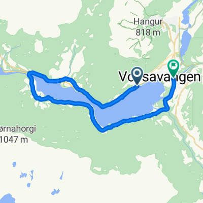
87. Vossevangen to Norheimsund
A cycling route starting in Voss, Hordaland, Norway.
Overview
About this route
Alternate to cross fjord by ferry twice and cycle quieter side
- -:--
- Duration
- 78.5 km
- Distance
- 2,260 m
- Ascent
- 2,319 m
- Descent
- ---
- Avg. speed
- 270 m
- Max. altitude

Route quality
Waytypes & surfaces along the route
Waytypes
Busy road
43.8 km
(56 %)
Cycleway
21.5 km
(27 %)
Surfaces
Paved
13.9 km
(18 %)
Unpaved
0 km
(<1 %)
Asphalt
13.9 km
(18 %)
Pebblestone
0 km
(<1 %)
Undefined
64.5 km
(82 %)
Route highlights
Points of interest along the route
Point of interest after 0.3 km
Vangskyrkja Voss
Drinking water after 0.6 km
Vangen Café
Drinking water after 0.8 km
VossaBakst AS Bakery
Point of interest after 15.1 km
Tunsbergtunnelen Length: 4080m Lighting: Yes Comments : Closed to cyclists. The cycle route just sticks to the old road, down or up the hairpins by the waterfalls, there are a few signposts for the cycle route, but they aren't completely clear. If heading south, there's a road sign to 'Seim'. Going north, there's a cycle-path sign to Voss, but someone's swivelled it round so it points 180-degrees in the wrong direction!. Alternative route : Use the old RV13 road through the valley.
Point of interest after 17.6 km
Skjervsfossen Waterfall
Point of interest after 17.6 km
Skorvofossen
Point of interest after 28 km
Gullhammartunnelen Length: 194m Lighting: Yes Comments : Closed to cyclist, but alternative road. Alternative route : Cycle road on the west side of the lake, very quiet, with a very good road layer, see more info.
Accommodation after 29.6 km
Jaunsen Gjestgjevarstad AS
Point of interest after 29.6 km
Coop Marked Granvin
Accommodation after 29.8 km
Heradshuset
Point of interest after 33.8 km
Folkedalstunnelen Length: 1370m Lighting: Yes Comments : Opened December 2015. Well lit modern tunnel with mostly low traffic.

Point of interest after 42.1 km
Bjørgatunnelen Length: 1568m Lighting: Yes Comments : Opened November 2016. Well lit modern tunnel. Alternative route : Use old road through Lussand.
Point of interest after 43.2 km
Lussandtunnelen Length: 95m Lighting: None. Comments : A short easy tunnel.
Point of interest after 54 km
Vikedalsnebbet viewpoint From the parking lot, you walk just under an hour on a plateau to the viewpoint. (160 m altitude) Wonderful view of the Hardangerfjord. Not overcrowded and not a strenuous hike.
Drinking water after 63.3 km
Steinstø Kakebu AS Cafe
Point of interest after 65.5 km
Høyviktunnelen Length: 66m Lighting: ? Comments : Really short easy and amazing tunnel.
Point of interest after 68.4 km
Skårsvatnet (Gullfiskdam)
Point of interest after 72.2 km
Øystese kyrkje
Accommodation after 72.3 km
Hardangerfjord Hotel

Point of interest after 73 km
Børvenestunnelen Length: 1210m Lighting: ? Comments : A new tunnel closed to cyclists. Alternative route : Heading east-west, there's no signed alternative for cycles as far as I can see, but just sticking to the old fjord road which is signposted to Børve, but marked as a dead-end. It bypasses the tunnel without problems. There is a cycle-path sign at the west end of the tunnel.
Continue with Bikemap
Use, edit, or download this cycling route
You would like to ride 87. Vossevangen to Norheimsund or customize it for your own trip? Here is what you can do with this Bikemap route:
Free features
- Save this route as favorite or in collections
- Copy & plan your own version of this route
- Sync your route with Garmin or Wahoo
Premium features
Free trial for 3 days, or one-time payment. More about Bikemap Premium.
- Navigate this route on iOS & Android
- Export a GPX / KML file of this route
- Create your custom printout (try it for free)
- Download this route for offline navigation
Discover more Premium features.
Get Bikemap PremiumFrom our community
Other popular routes starting in Voss
 Hardangerfjord route Voss - Rosendal - Sunde - Leirvik
- Distance
- 228 km
- Ascent
- 0 m
- Descent
- 0 m
- Location
- Voss, Hordaland, Norway
 NOR 050: Runde bei Voss
- Distance
- 14.2 km
- Ascent
- 0 m
- Descent
- 0 m
- Location
- Voss, Hordaland, Norway
 Da Evangervegen 15 a Evangervegen 9
- Distance
- 24.1 km
- Ascent
- 417 m
- Descent
- 410 m
- Location
- Voss, Hordaland, Norway
 Voss-Bergen
- Distance
- 172.4 km
- Ascent
- 1,786 m
- Descent
- 1,532 m
- Location
- Voss, Hordaland, Norway
 Flatlandsmo-Kløve-rundt Vangsvatnet
- Distance
- 60.5 km
- Ascent
- 712 m
- Descent
- 737 m
- Location
- Voss, Hordaland, Norway
 Voss-Geilo 2013
- Distance
- 162.1 km
- Ascent
- 2,741 m
- Descent
- 2,000 m
- Location
- Voss, Hordaland, Norway
 VOSS
VOSS- Distance
- 6.4 km
- Ascent
- 698 m
- Descent
- 291 m
- Location
- Voss, Hordaland, Norway
 Vangsvatnet uten sentrum
- Distance
- 20.4 km
- Ascent
- 265 m
- Descent
- 266 m
- Location
- Voss, Hordaland, Norway
Open it in the app