

Bickenalb Runde
A cycling route starting in Hornbach, Rhineland-Palatinate, Germany.
Overview
About this route
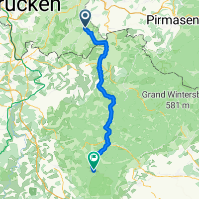
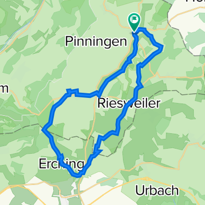
Start/Finish: Church in Altheim / The Bickenalb (French: Bickenalbe) is a 17 km long tributary of the Hornbach, originating in the Lorraine village of Petit-Réderching and joining the Hornbach just before Ixheim, a district of Zweibrücken. The 23 km long, very well-signposted circular tour "Bickenalb Runde" takes you between Altheim and Guiderkirch onto the valley heights on both sides of the Bickenalb with fantastic views of the valley region. / The starting point of the tour is at the information board near the church in Altheim and climbs from there to the heights around Riesweiler and Utweiler. From Utweiler, the route descends into the Lorraine valley to Guiderkirch and then climbs again to the heights around Medelsheim via Erching. Via Medelsheim and from Peppenkum along the Bickenalb, you return to the starting point of the tour. / More cycling tours in Saarpfalz at: / www.radtouren-saarpfalz.jimdo.com
- -:--
- Duration
- 22.9 km
- Distance
- 292 m
- Ascent
- 293 m
- Descent
- ---
- Avg. speed
- 380 m
- Max. altitude
Route quality
Waytypes & surfaces along the route
Waytypes
Track
13.5 km
(59 %)
Quiet road
3 km
(13 %)
Surfaces
Paved
18.8 km
(82 %)
Unpaved
3.4 km
(15 %)
Asphalt
11.7 km
(51 %)
Paved (undefined)
6.9 km
(30 %)
Continue with Bikemap
Use, edit, or download this cycling route
You would like to ride Bickenalb Runde or customize it for your own trip? Here is what you can do with this Bikemap route:
Free features
- Save this route as favorite or in collections
- Copy & plan your own version of this route
- Sync your route with Garmin or Wahoo
Premium features
Free trial for 3 days, or one-time payment. More about Bikemap Premium.
- Navigate this route on iOS & Android
- Export a GPX / KML file of this route
- Create your custom printout (try it for free)
- Download this route for offline navigation
Discover more Premium features.
Get Bikemap PremiumFrom our community
Other popular routes starting in Hornbach
 Teil des Europäischen Mühlenradweges
- Distance
- 32.8 km
- Ascent
- 336 m
- Descent
- 339 m
- Location
- Hornbach, Rhineland-Palatinate, Germany
 10. Hornbach - Vinningen - Wissembourg
- Distance
- 72.4 km
- Ascent
- 551 m
- Descent
- 632 m
- Location
- Hornbach, Rhineland-Palatinate, Germany
 Europäischer Mühlenradweg CLONED FROM ROUTE 68410
- Distance
- 35.7 km
- Ascent
- 293 m
- Descent
- 286 m
- Location
- Hornbach, Rhineland-Palatinate, Germany
 DT, Trails und Hügel
- Distance
- 42.9 km
- Ascent
- 680 m
- Descent
- 677 m
- Location
- Hornbach, Rhineland-Palatinate, Germany
 Zum Cafe nach La Petite Pierre und Retour
- Distance
- 52.3 km
- Ascent
- 500 m
- Descent
- 459 m
- Location
- Hornbach, Rhineland-Palatinate, Germany
 Bickenalb Runde
- Distance
- 22.9 km
- Ascent
- 292 m
- Descent
- 293 m
- Location
- Hornbach, Rhineland-Palatinate, Germany
 Col de Wengelsbach und zurück
- Distance
- 65.5 km
- Ascent
- 631 m
- Descent
- 536 m
- Location
- Hornbach, Rhineland-Palatinate, Germany
 Feierabend Runde
- Distance
- 47.9 km
- Ascent
- 522 m
- Descent
- 567 m
- Location
- Hornbach, Rhineland-Palatinate, Germany
Open it in the app