OB J7 PM 2
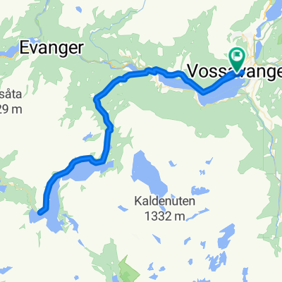
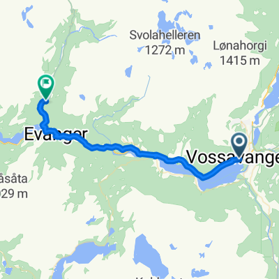
- 25.8 km
- 313 m
- 300 m
- Voss, Hordaland, Norway
A cycling route starting in Voss, Hordaland, Norway.
Overview
39km to Kvanndal ferry 36km to Jondal ferry 14km to Norheimsund ... total 89km cycling
created this 3 years ago
Route quality
Cycleway
33.6 km
(34 %)
Road
6.9 km
(7 %)
Paved
69.3 km
(70 %)
Asphalt
69.3 km
(70 %)
Undefined
29.7 km
(30 %)
Route highlights
Scandic Voss
Fleischer's Hotel
Vangskyrkja Voss
Vangen Café
VossaBakst AS Bakery
Tunsbergtunnelen Length: 4080m Lighting: Yes Comments : Closed to cyclists. The cycle route just sticks to the old road, down or up the hairpins by the waterfalls, there are a few signposts for the cycle route, but they aren't completely clear. If heading south, there's a road sign to 'Seim'. Going north, there's a cycle-path sign to Voss, but someone's swivelled it round so it points 180-degrees in the wrong direction!. Alternative route : Use the old RV13 road through the valley.
Skjervsfossen Waterfall
Skorvofossen
Gullhammartunnelen Length: 194m Lighting: Yes Comments : Closed to cyclist, but alternative road. Alternative route : Cycle road on the west side of the lake, very quiet, with a very good road layer, see more info.
Jaunsen Gjestgjevarstad AS
Coop Marked Granvin
Heradshuset
Folkedalstunnelen Length: 1370m Lighting: Yes Comments : Opened December 2015. Well lit modern tunnel with mostly low traffic.
Kvanndal to Utne ferry M-F 0740 then hourly from 0900 Journey 20 min Sa hourly from 0700 Su hourly from 0800
Hardanger Folk Museum
Samlen
Rock-pictures
Meieriet Restaurant
Herand Groceries
Jonatunnelen Length: 731m Lighting: Yes Comments : Not much traffic, easy to cycle
Monsatunnelen Length: 137m Lighting: Yes Comments : Short, not much traffic, easy to cycle.
Coop
Jondal to Tørvikbygd ferry 20 min Hourly at 20 past the hour
Vangdalsbergetunnelen Length: 430m Lighting: ? Comments : Last I checked it was made legal to use this tunnel. I believe they closed the old road outside due to rock fall risk. Speed was reduced and warning signs of cyclist in tunnel was set up.
Salthammeren Stone Age Carvings
Vikøy kyrkje
Hardanger Maritime Centre
Thon Hotel Sandven
Continue with Bikemap
You would like to ride 87A. Vossevangen to Norheimsund via ferries or customize it for your own trip? Here is what you can do with this Bikemap route:
Free trial for 3 days, or one-time payment. More about Bikemap Premium.
Discover more Premium features.
Get Bikemap PremiumFrom our community
Open it in the app