

2008_08 Humenné_Bylnice
Chata v Zádielské dolině_Ratková
A cycling route starting in Medzev, Košice Region, Slovakia.
Overview
About this route
S Věrou.
- -:--
- Duration
- 86.6 km
- Distance
- 742 m
- Ascent
- 1,123 m
- Descent
- ---
- Avg. speed
- ---
- Max. altitude

Part of
2008_08 Humenné_Bylnice
8 stages
Route highlights
Points of interest along the route
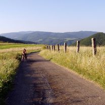
Point of interest after 86.6 km
Spaní pod širákem.
Continue with Bikemap
Use, edit, or download this cycling route
You would like to ride Chata v Zádielské dolině_Ratková or customize it for your own trip? Here is what you can do with this Bikemap route:
Free features
- Save this route as favorite or in collections
- Copy & plan your own version of this route
- Split it into stages to create a multi-day tour
- Sync your route with Garmin or Wahoo
Premium features
Free trial for 3 days, or one-time payment. More about Bikemap Premium.
- Navigate this route on iOS & Android
- Export a GPX / KML file of this route
- Create your custom printout (try it for free)
- Download this route for offline navigation
Discover more Premium features.
Get Bikemap PremiumFrom our community
Other popular routes starting in Medzev
 Jasov - Muráň
- Distance
- 100.2 km
- Ascent
- 1,807 m
- Descent
- 1,682 m
- Location
- Medzev, Košice Region, Slovakia
 Zadielska tiesnava - Hacava
- Distance
- 23.6 km
- Ascent
- 949 m
- Descent
- 947 m
- Location
- Medzev, Košice Region, Slovakia
 Kojsovka
- Distance
- 7.3 km
- Ascent
- 534 m
- Descent
- 6 m
- Location
- Medzev, Košice Region, Slovakia
 Chata v Zádielské dolině_Ratková
- Distance
- 86.6 km
- Ascent
- 742 m
- Descent
- 1,123 m
- Location
- Medzev, Košice Region, Slovakia
 Kloptaň-Prakovce
- Distance
- 6.9 km
- Ascent
- 80 m
- Descent
- 796 m
- Location
- Medzev, Košice Region, Slovakia
 Smolník stara dolina a späť.
- Distance
- 15.2 km
- Ascent
- 635 m
- Descent
- 636 m
- Location
- Medzev, Košice Region, Slovakia
 Karst Tour 2015
- Distance
- 43.6 km
- Ascent
- 1,468 m
- Descent
- 1,468 m
- Location
- Medzev, Košice Region, Slovakia
 Zlata Idka - Jahodna
- Distance
- 19.7 km
- Ascent
- 505 m
- Descent
- 625 m
- Location
- Medzev, Košice Region, Slovakia
Open it in the app