

2011_Budapest-Sofia_03
A cycling route starting in Mali Iđoš, Vojvodina, Serbia.
Overview
About this route
- Etappe (02.08.2011):
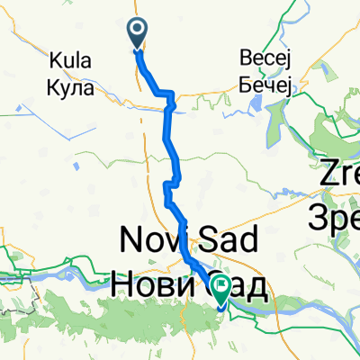
Start: Motel & Camping Pipacs, Feketič
Ziel: Camping Dunav, Zemun
- -:--
- Duration
- 113.4 km
- Distance
- 251 m
- Ascent
- 249 m
- Descent
- ---
- Avg. speed
- ---
- Max. altitude

Route quality
Waytypes & surfaces along the route
Waytypes
Quiet road
15.9 km
(14 %)
Track
15.9 km
(14 %)
Surfaces
Paved
82.8 km
(73 %)
Asphalt
57.8 km
(51 %)
Paved (undefined)
24.9 km
(22 %)
Undefined
30.6 km
(27 %)
Route highlights
Points of interest along the route
Point of interest after 0.1 km
Motel und Camping Pipacs M.Tita 62., 24323 Feketić, Serbien Telefon:+381 24 738028
Point of interest after 113.4 km
Camping Dunav Zemun, Batajnički drum 7 deo broj 12 Belgrade ,Serbia Tel: +381 11 21 99 072 , Tel: +381 11 63 04 862 E-mail: campdunav@amkjedinstvo.rs
Continue with Bikemap
Use, edit, or download this cycling route
You would like to ride 2011_Budapest-Sofia_03 or customize it for your own trip? Here is what you can do with this Bikemap route:
Free features
- Save this route as favorite or in collections
- Copy & plan your own version of this route
- Split it into stages to create a multi-day tour
- Sync your route with Garmin or Wahoo
Premium features
Free trial for 3 days, or one-time payment. More about Bikemap Premium.
- Navigate this route on iOS & Android
- Export a GPX / KML file of this route
- Create your custom printout (try it for free)
- Download this route for offline navigation
Discover more Premium features.
Get Bikemap PremiumFrom our community
Other popular routes starting in Mali Iđoš
 2011_Budapest-Sofia_03
- Distance
- 113.4 km
- Ascent
- 251 m
- Descent
- 249 m
- Location
- Mali Iđoš, Vojvodina, Serbia
 Steady ride in Mali Iđoš
- Distance
- 12.2 km
- Ascent
- 68 m
- Descent
- 72 m
- Location
- Mali Iđoš, Vojvodina, Serbia
 etappe 39
- Distance
- 68.2 km
- Ascent
- 166 m
- Descent
- 97 m
- Location
- Mali Iđoš, Vojvodina, Serbia
 Omladinska, Mилешево to Зелена 25, Бечеј
- Distance
- 22.4 km
- Ascent
- 4 m
- Descent
- 13 m
- Location
- Mali Iđoš, Vojvodina, Serbia
 109 3, Mилешево to Србија, Србобран
- Distance
- 22.4 km
- Ascent
- 3 m
- Descent
- 12 m
- Location
- Mali Iđoš, Vojvodina, Serbia
 Route to Ulica Edvarda Kardelja 12, Backa Topola
- Distance
- 44.4 km
- Ascent
- 304 m
- Descent
- 302 m
- Location
- Mali Iđoš, Vojvodina, Serbia
 109 3, Mилешево to Ивана Милутиновића 12, Врбас
- Distance
- 36.5 km
- Ascent
- 21 m
- Descent
- 30 m
- Location
- Mali Iđoš, Vojvodina, Serbia
 109 3, Mилешево to Ивана Милутиновића 12, Врбас
- Distance
- 25.1 km
- Ascent
- 21 m
- Descent
- 32 m
- Location
- Mali Iđoš, Vojvodina, Serbia
Open it in the app