

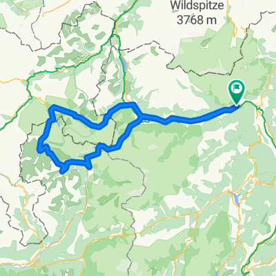
Mendelpass - Gampenjoch
A cycling route starting in Rablà, Trentino-Alto Adige, Italy.
Overview
About this route
- -:--
- Duration
- 84.9 km
- Distance
- 1,638 m
- Ascent
- 1,924 m
- Descent
- ---
- Avg. speed
- ---
- Max. altitude

Route quality
Waytypes & surfaces along the route
Waytypes
Busy road
66.4 km
(78 %)
Quiet road
5.6 km
(7 %)
Surfaces
Paved
74.6 km
(88 %)
Unpaved
1.3 km
(2 %)
Asphalt
74.3 km
(87 %)
Gravel
1 km
(1 %)
Continue with Bikemap
Use, edit, or download this cycling route
You would like to ride Mendelpass - Gampenjoch or customize it for your own trip? Here is what you can do with this Bikemap route:
Free features
- Save this route as favorite or in collections
- Copy & plan your own version of this route
- Split it into stages to create a multi-day tour
- Sync your route with Garmin or Wahoo
Premium features
Free trial for 3 days, or one-time payment. More about Bikemap Premium.
- Navigate this route on iOS & Android
- Export a GPX / KML file of this route
- Create your custom printout (try it for free)
- Download this route for offline navigation
Discover more Premium features.
Get Bikemap PremiumFrom our community
Other popular routes starting in Rablà
 Cutraunstraße 60, Rabland nach Via San Zeno 13, Naturno
- Distance
- 32.4 km
- Ascent
- 388 m
- Descent
- 339 m
- Location
- Rablà, Trentino-Alto Adige, Italy
 Meran1
- Distance
- 31.5 km
- Ascent
- 1,750 m
- Descent
- 285 m
- Location
- Rablà, Trentino-Alto Adige, Italy
 Trans Alp 2013 - Psycho Cross - Etappe 5
- Distance
- 49.6 km
- Ascent
- 3,122 m
- Descent
- 2,166 m
- Location
- Rablà, Trentino-Alto Adige, Italy
 Passo Stelvio
- Distance
- 219 km
- Ascent
- 3,721 m
- Descent
- 3,721 m
- Location
- Rablà, Trentino-Alto Adige, Italy
 29.04.2010 Rabland - Töll - Naturns - Tabland
- Distance
- 25.7 km
- Ascent
- 271 m
- Descent
- 271 m
- Location
- Rablà, Trentino-Alto Adige, Italy
 Route nach Jochweg 17–19, Marling
- Distance
- 6.1 km
- Ascent
- 0 m
- Descent
- 0 m
- Location
- Rablà, Trentino-Alto Adige, Italy
 Vigiljoch2
- Distance
- 22.1 km
- Ascent
- 1,354 m
- Descent
- 1,358 m
- Location
- Rablà, Trentino-Alto Adige, Italy
 Vigiljoch
- Distance
- 24.5 km
- Ascent
- 1,409 m
- Descent
- 1,409 m
- Location
- Rablà, Trentino-Alto Adige, Italy
Open it in the app