

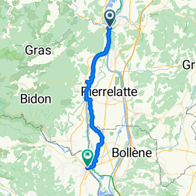
Dia 4 - Viviers a Avignon
A cycling route starting in Viviers, Auvergne-Rhône-Alpes, France.
Overview
About this route
- -:--
- Duration
- 82.7 km
- Distance
- 283 m
- Ascent
- 326 m
- Descent
- ---
- Avg. speed
- 121 m
- Max. altitude

Route quality
Waytypes & surfaces along the route
Waytypes
Quiet road
42.2 km
(51 %)
Cycleway
10.8 km
(13 %)
Surfaces
Paved
70.3 km
(85 %)
Unpaved
0.8 km
(1 %)
Asphalt
69.5 km
(84 %)
Concrete
0.8 km
(1 %)
Route highlights
Points of interest along the route
Point of interest after 23.1 km
Almuerzo o Cafe
Continue with Bikemap
Use, edit, or download this cycling route
You would like to ride Dia 4 - Viviers a Avignon or customize it for your own trip? Here is what you can do with this Bikemap route:
Free features
- Save this route as favorite or in collections
- Copy & plan your own version of this route
- Split it into stages to create a multi-day tour
- Sync your route with Garmin or Wahoo
Premium features
Free trial for 3 days, or one-time payment. More about Bikemap Premium.
- Navigate this route on iOS & Android
- Export a GPX / KML file of this route
- Create your custom printout (try it for free)
- Download this route for offline navigation
Discover more Premium features.
Get Bikemap PremiumFrom our community
Other popular routes starting in Viviers
 2 Viviers - Chateauneuf
- Distance
- 65.7 km
- Ascent
- 154 m
- Descent
- 188 m
- Location
- Viviers, Auvergne-Rhône-Alpes, France
 2014_E12_Viviers_Sanilhac
- Distance
- 81.5 km
- Ascent
- 439 m
- Descent
- 364 m
- Location
- Viviers, Auvergne-Rhône-Alpes, France
 Rhone 1/5
- Distance
- 66.7 km
- Ascent
- 73 m
- Descent
- 111 m
- Location
- Viviers, Auvergne-Rhône-Alpes, France
 Donère->Frontignan
- Distance
- 202 km
- Ascent
- 434 m
- Descent
- 511 m
- Location
- Viviers, Auvergne-Rhône-Alpes, France
 Dia 4 - Viviers a Avignon
- Distance
- 82.7 km
- Ascent
- 283 m
- Descent
- 326 m
- Location
- Viviers, Auvergne-Rhône-Alpes, France
 Place de la Roubine 2, Viviers nach L'Argentane 17, Saint-Paul-Trois-Châteaux
- Distance
- 21.1 km
- Ascent
- 178 m
- Descent
- 155 m
- Location
- Viviers, Auvergne-Rhône-Alpes, France
 Dia 4 - Viviers a Avignon
- Distance
- 90.3 km
- Ascent
- 274 m
- Descent
- 319 m
- Location
- Viviers, Auvergne-Rhône-Alpes, France
 Activity - 16: ViaRhôna de Viviers / Bourg-Saint-Andéol à Lapalud
- Distance
- 36.4 km
- Ascent
- 96 m
- Descent
- 105 m
- Location
- Viviers, Auvergne-Rhône-Alpes, France
Open it in the app