Manuel A. Roxas Highway M.A, Angeles to Manuel A. Roxas Highway M.A, Angeles
A cycling route starting in Santol, Central Luzon, Philippines.
Overview
About this route
- 3 h 31 min
- Duration
- 57.4 km
- Distance
- 349 m
- Ascent
- 349 m
- Descent
- 16.3 km/h
- Avg. speed
- 259 m
- Avg. speed
Route quality
Waytypes & surfaces along the route
Waytypes
Busy road
24.5 km
(43 %)
Cycleway
11.3 km
(20 %)
Surfaces
Paved
47.1 km
(82 %)
Concrete
33 km
(57 %)
Asphalt
9 km
(16 %)
Continue with Bikemap
Use, edit, or download this cycling route
You would like to ride Manuel A. Roxas Highway M.A, Angeles to Manuel A. Roxas Highway M.A, Angeles or customize it for your own trip? Here is what you can do with this Bikemap route:
Free features
- Save this route as favorite or in collections
- Copy & plan your own version of this route
- Sync your route with Garmin or Wahoo
Premium features
Free trial for 3 days, or one-time payment. More about Bikemap Premium.
- Navigate this route on iOS & Android
- Export a GPX / KML file of this route
- Create your custom printout (try it for free)
- Download this route for offline navigation
Discover more Premium features.
Get Bikemap PremiumFrom our community
Other popular routes starting in Santol
- Bike Route
- Distance
- 9.7 km
- Ascent
- 8 m
- Descent
- 75 m
- Location
- Santol, Central Luzon, Philippines
- Jose P Laurel Avenue 526, Angeles to Merville Access Road 4, Pasay
- Distance
- 122.5 km
- Ascent
- 626 m
- Descent
- 795 m
- Location
- Santol, Central Luzon, Philippines
- Restful route in Angeles City
- Distance
- 18.9 km
- Ascent
- 162 m
- Descent
- 161 m
- Location
- Santol, Central Luzon, Philippines
- Relaxed route
- Distance
- 21.1 km
- Ascent
- 237 m
- Descent
- 225 m
- Location
- Santol, Central Luzon, Philippines
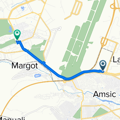
- Clark Quest mini loop
- Distance
- 10.6 km
- Ascent
- 98 m
- Descent
- 97 m
- Location
- Santol, Central Luzon, Philippines
- Aqua planet
- Distance
- 12.1 km
- Ascent
- 91 m
- Descent
- 95 m
- Location
- Santol, Central Luzon, Philippines
- Mount Arayat Street 912, Angeles to Mount Makiling Street 3, Angeles
- Distance
- 5.2 km
- Ascent
- 12 m
- Descent
- 10 m
- Location
- Santol, Central Luzon, Philippines
- clark route
- Distance
- 44.1 km
- Ascent
- 647 m
- Descent
- 650 m
- Location
- Santol, Central Luzon, Philippines
Open it in the app