

Mühlstetten W Kneipp-Tour
A cycling route starting in Röttenbach, Bavaria, Germany.
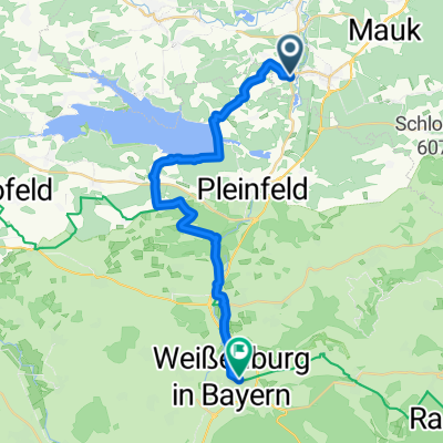
Overview
About this route
The start is at the e-charging station in Mühlstetten, see map.
Warning: Inaccurate route marking
Let’s go on a lively, wet hiking tour: the Röttenbacher Kneip(p)entour not only invites you to hike in beautiful nature but also to take care of your physical well-being.
- -:--
- Duration
- 9.5 km
- Distance
- 144 m
- Ascent
- 143 m
- Descent
- ---
- Avg. speed
- 414 m
- Max. altitude

Route quality
Waytypes & surfaces along the route
Waytypes
Track
4.6 km
(48 %)
Quiet road
2.2 km
(23 %)
Surfaces
Paved
4 km
(42 %)
Unpaved
4.6 km
(48 %)
Asphalt
4 km
(42 %)
Gravel
2.1 km
(22 %)
Route highlights
Points of interest along the route
Point of interest after 1.7 km
E-Ladesäule
Continue with Bikemap
Use, edit, or download this cycling route
You would like to ride Mühlstetten W Kneipp-Tour or customize it for your own trip? Here is what you can do with this Bikemap route:
Free features
- Save this route as favorite or in collections
- Copy & plan your own version of this route
- Sync your route with Garmin or Wahoo
Premium features
Free trial for 3 days, or one-time payment. More about Bikemap Premium.
- Navigate this route on iOS & Android
- Export a GPX / KML file of this route
- Create your custom printout (try it for free)
- Download this route for offline navigation
Discover more Premium features.
Get Bikemap PremiumFrom our community
Other popular routes starting in Röttenbach
 Mühlstetten W Kneipp-Tour
- Distance
- 9.5 km
- Ascent
- 144 m
- Descent
- 143 m
- Location
- Röttenbach, Bavaria, Germany
 Röttenbach-Hilpoltstein-Röttenbach
- Distance
- 31.6 km
- Ascent
- 214 m
- Descent
- 215 m
- Location
- Röttenbach, Bavaria, Germany
 Stirn-Spalt-Windsbach
- Distance
- 26.8 km
- Ascent
- 349 m
- Descent
- 378 m
- Location
- Röttenbach, Bavaria, Germany
 Walk1
Walk1- Distance
- 5.6 km
- Ascent
- 72 m
- Descent
- 70 m
- Location
- Röttenbach, Bavaria, Germany
 Röttenbach-Eglasmühle
- Distance
- 43.6 km
- Ascent
- 410 m
- Descent
- 400 m
- Location
- Röttenbach, Bavaria, Germany
 Röttenbach - Rodelbahn Pleinfeld
- Distance
- 9.1 km
- Ascent
- 97 m
- Descent
- 69 m
- Location
- Röttenbach, Bavaria, Germany
 S-Bahn Brombach Weissenburg
- Distance
- 23.7 km
- Ascent
- 276 m
- Descent
- 221 m
- Location
- Röttenbach, Bavaria, Germany
 Rund um Röttenbach
- Distance
- 10.1 km
- Ascent
- 177 m
- Descent
- 174 m
- Location
- Röttenbach, Bavaria, Germany
Open it in the app