

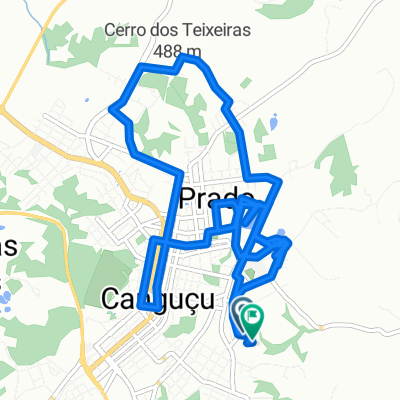
De Rua Tenente Edgar Werlhi 379 a Rua Tenente Edgar Werlhi 379
A cycling route starting in Canguçu, Rio Grande do Sul, Brazil.
Overview
About this route
- 1 h 39 min
- Duration
- 4.7 km
- Distance
- 140 m
- Ascent
- 145 m
- Descent
- 2.8 km/h
- Avg. speed
- 436 m
- Max. altitude

Continue with Bikemap
Use, edit, or download this cycling route
You would like to ride De Rua Tenente Edgar Werlhi 379 a Rua Tenente Edgar Werlhi 379 or customize it for your own trip? Here is what you can do with this Bikemap route:
Free features
- Save this route as favorite or in collections
- Copy & plan your own version of this route
- Sync your route with Garmin or Wahoo
Premium features
Free trial for 3 days, or one-time payment. More about Bikemap Premium.
- Navigate this route on iOS & Android
- Export a GPX / KML file of this route
- Create your custom printout (try it for free)
- Download this route for offline navigation
Discover more Premium features.
Get Bikemap PremiumFrom our community
Other popular routes starting in Canguçu
 De Rua Antônio Florêncio Duarte 177 a Rua Cândido Nunes da Silveira 16
- Distance
- 16.7 km
- Ascent
- 315 m
- Descent
- 332 m
- Location
- Canguçu, Rio Grande do Sul, Brazil
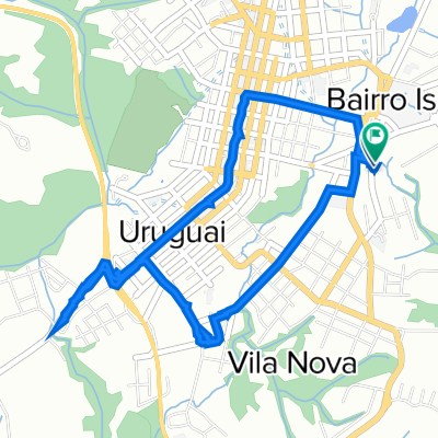 De Rua Vitorio Ney 403 a Rua Tenente Edgar Werlhi 379
- Distance
- 5.8 km
- Ascent
- 121 m
- Descent
- 113 m
- Location
- Canguçu, Rio Grande do Sul, Brazil
 De Rua Vitorio Ney 427 a Rua Professora Neuza Paes do Amaral 292
- Distance
- 3.2 km
- Ascent
- 94 m
- Descent
- 114 m
- Location
- Canguçu, Rio Grande do Sul, Brazil
 De Rua Tenente Edgar Werlhi 379 a Rua Tenente Edgar Werlhi 379
- Distance
- 4.7 km
- Ascent
- 140 m
- Descent
- 145 m
- Location
- Canguçu, Rio Grande do Sul, Brazil
 sitio da pedra grande
- Distance
- 5.5 km
- Ascent
- 147 m
- Descent
- 146 m
- Location
- Canguçu, Rio Grande do Sul, Brazil
 De Estrada Coxilha dos Campos a Estrada Coxilha dos Campos
- Distance
- 16 km
- Ascent
- 140 m
- Descent
- 0 m
- Location
- Canguçu, Rio Grande do Sul, Brazil
 Roteiro Agroecológico - 14/09/14
- Distance
- 13.3 km
- Ascent
- 269 m
- Descent
- 222 m
- Location
- Canguçu, Rio Grande do Sul, Brazil
 vó do Pierre
- Distance
- 27.1 km
- Ascent
- 780 m
- Descent
- 763 m
- Location
- Canguçu, Rio Grande do Sul, Brazil
Open it in the app