

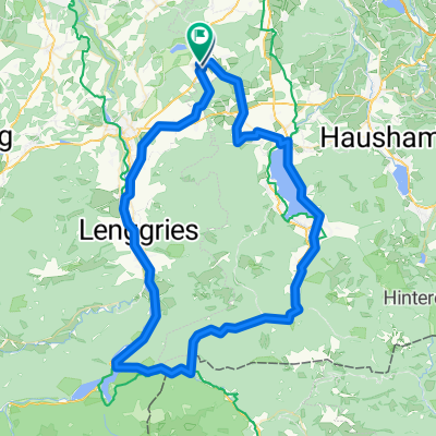
Reutberg-Kirchsee-Ellbach Rundweg
A cycling route starting in Sachsenkam, Bavaria, Germany.
Overview
About this route
still in progress, moderately difficult only due to the route length of about 15 km on the shorter option; unfortunately, part of it runs along the road.
- -:--
- Duration
- 20.6 km
- Distance
- 254 m
- Ascent
- 257 m
- Descent
- ---
- Avg. speed
- 733 m
- Max. altitude

Route quality
Waytypes & surfaces along the route
Waytypes
Track
8.7 km
(42 %)
Road
6.6 km
(32 %)
Surfaces
Paved
12.4 km
(60 %)
Unpaved
7.2 km
(35 %)
Asphalt
12.2 km
(59 %)
Pebblestone
3.5 km
(17 %)
Route highlights
Points of interest along the route
Point of interest after 1.7 km
Dritte Pause
Point of interest after 3 km
kleine Pausebank
Point of interest after 8.6 km
nettes Wirtshaus
Point of interest after 14.2 km
Erste Pause
Continue with Bikemap
Use, edit, or download this cycling route
You would like to ride Reutberg-Kirchsee-Ellbach Rundweg or customize it for your own trip? Here is what you can do with this Bikemap route:
Free features
- Save this route as favorite or in collections
- Copy & plan your own version of this route
- Sync your route with Garmin or Wahoo
Premium features
Free trial for 3 days, or one-time payment. More about Bikemap Premium.
- Navigate this route on iOS & Android
- Export a GPX / KML file of this route
- Create your custom printout (try it for free)
- Download this route for offline navigation
Discover more Premium features.
Get Bikemap PremiumFrom our community
Other popular routes starting in Sachsenkam
 RC03 ObRunde 2 Gruppe C
- Distance
- 41.1 km
- Ascent
- 359 m
- Descent
- 359 m
- Location
- Sachsenkam, Bavaria, Germany
 Babenberg-Innsbruck loop
- Distance
- 373.6 km
- Ascent
- 1,405 m
- Descent
- 1,405 m
- Location
- Sachsenkam, Bavaria, Germany
 Triathlon
- Distance
- 40.1 km
- Ascent
- 357 m
- Descent
- 392 m
- Location
- Sachsenkam, Bavaria, Germany
 SAC Achenpaß SAC
- Distance
- 83.5 km
- Ascent
- 424 m
- Descent
- 434 m
- Location
- Sachsenkam, Bavaria, Germany
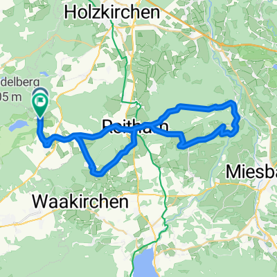
 Kloster Reutberg to Bad Tölz and back via Kirchsee
- Distance
- 22 km
- Ascent
- 116 m
- Descent
- 117 m
- Location
- Sachsenkam, Bavaria, Germany
 taubenberg
- Distance
- 38.2 km
- Ascent
- 561 m
- Descent
- 521 m
- Location
- Sachsenkam, Bavaria, Germany
 SAC Walchensee Kochelsee SAC
- Distance
- 110.1 km
- Ascent
- 566 m
- Descent
- 573 m
- Location
- Sachsenkam, Bavaria, Germany
 Sachsenkamm - Taubenberg - Kirchsee - Bad Tölz
- Distance
- 53.6 km
- Ascent
- 548 m
- Descent
- 546 m
- Location
- Sachsenkam, Bavaria, Germany
Open it in the app