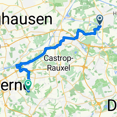
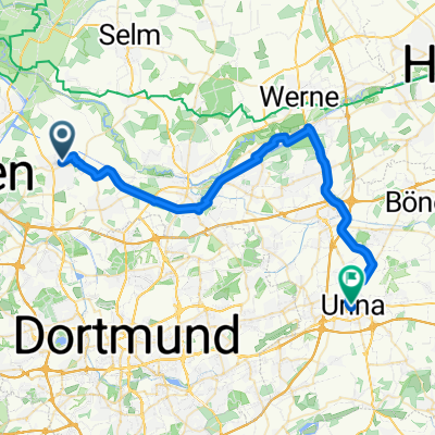
Brambauer Seilbahn -> Horstmarer See
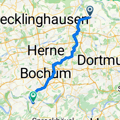
A cycling route starting in Waltrop, North Rhine-Westphalia, Germany.
Overview
About this route
Die beginnt in Brambauer und führt über die "alte Seilbahn" am ehemaligen Zechengelände vorbei und verläuft dann am Datteln-Hamm-Kanal bis zum Horstmarer See. Eine sehr ebene Strecke und sehr gut ausgebaute Schotterwege.
- -:--
- Duration
- 9.1 km
- Distance
- 31 m
- Ascent
- 49 m
- Descent
- ---
- Avg. speed
- ---
- Avg. speed
Route quality
Waytypes & surfaces along the route
Waytypes
Path
4.9 km
(54 %)
Track
3.9 km
(43 %)
Surfaces
Paved
3.8 km
(42 %)
Unpaved
5.3 km
(58 %)
Gravel
4.8 km
(53 %)
Asphalt
2.6 km
(29 %)
Continue with Bikemap
Use, edit, or download this cycling route
You would like to ride Brambauer Seilbahn -> Horstmarer See or customize it for your own trip? Here is what you can do with this Bikemap route:
Free features
- Save this route as favorite or in collections
- Copy & plan your own version of this route
- Sync your route with Garmin or Wahoo
Premium features
Free trial for 3 days, or one-time payment. More about Bikemap Premium.
- Navigate this route on iOS & Android
- Export a GPX / KML file of this route
- Create your custom printout (try it for free)
- Download this route for offline navigation
Discover more Premium features.
Get Bikemap PremiumFrom our community
Other popular routes starting in Waltrop
- König Ludwig Trasse Bis Halde
- Distance
- 27.8 km
- Ascent
- 175 m
- Descent
- 105 m
- Location
- Waltrop, North Rhine-Westphalia, Germany
- WA-LÜ-BOR-WA
- Distance
- 35.8 km
- Ascent
- 139 m
- Descent
- 139 m
- Location
- Waltrop, North Rhine-Westphalia, Germany
- Frühjahrs-RTF Waltrop
- Distance
- 102.8 km
- Ascent
- 303 m
- Descent
- 313 m
- Location
- Waltrop, North Rhine-Westphalia, Germany
- RTF Sprinter Waltrop
- Distance
- 110.2 km
- Ascent
- 310 m
- Descent
- 317 m
- Location
- Waltrop, North Rhine-Westphalia, Germany
- Castrop-Rauxel
- Distance
- 53.9 km
- Ascent
- 716 m
- Descent
- 722 m
- Location
- Waltrop, North Rhine-Westphalia, Germany
- Sonntag
- Distance
- 42.2 km
- Ascent
- 95 m
- Descent
- 93 m
- Location
- Waltrop, North Rhine-Westphalia, Germany
- Lüner Münsterlandrunde
- Distance
- 81.8 km
- Ascent
- 163 m
- Descent
- 163 m
- Location
- Waltrop, North Rhine-Westphalia, Germany
- Schleuse Henrichenburg n. Haltern aS 60 km
- Distance
- 59 km
- Ascent
- 126 m
- Descent
- 123 m
- Location
- Waltrop, North Rhine-Westphalia, Germany