

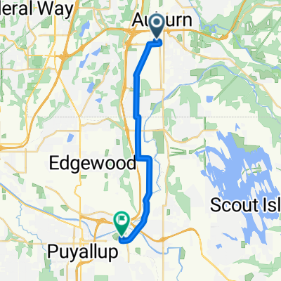
Interurban Trail, Auburn to 106 Kensington Ave S, Kent
A cycling route starting in Auburn, Washington, United States.
Overview
About this route
- 34 min
- Duration
- 7.5 km
- Distance
- 55 m
- Ascent
- 41 m
- Descent
- 13 km/h
- Avg. speed
- 34 m
- Max. altitude

Route quality
Waytypes & surfaces along the route
Waytypes
Cycleway
5.9 km
(79 %)
Quiet road
0.7 km
(10 %)
Surfaces
Paved
7.1 km
(95 %)
Asphalt
7.1 km
(95 %)
Undefined
0.4 km
(5 %)
Continue with Bikemap
Use, edit, or download this cycling route
You would like to ride Interurban Trail, Auburn to 106 Kensington Ave S, Kent or customize it for your own trip? Here is what you can do with this Bikemap route:
Free features
- Save this route as favorite or in collections
- Copy & plan your own version of this route
- Sync your route with Garmin or Wahoo
Premium features
Free trial for 3 days, or one-time payment. More about Bikemap Premium.
- Navigate this route on iOS & Android
- Export a GPX / KML file of this route
- Create your custom printout (try it for free)
- Download this route for offline navigation
Discover more Premium features.
Get Bikemap PremiumFrom our community
Other popular routes starting in Auburn
 M Street Southeast 1210, Auburn to West Main Street 804, Auburn
- Distance
- 3.4 km
- Ascent
- 0 m
- Descent
- 19 m
- Location
- Auburn, Washington, United States
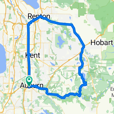
 auburn-home
- Distance
- 26 km
- Ascent
- 145 m
- Descent
- 37 m
- Location
- Auburn, Washington, United States
 Auburn Station to Fremont Avenue North 3418, Seattle
- Distance
- 57 km
- Ascent
- 246 m
- Descent
- 245 m
- Location
- Auburn, Washington, United States
 3rd Street Northeast 331, Auburn to 3rd Street Northeast 331, Auburn
- Distance
- 69.4 km
- Ascent
- 66 m
- Descent
- 92 m
- Location
- Auburn, Washington, United States
 Moderate route in Puyallup
- Distance
- 14.6 km
- Ascent
- 67 m
- Descent
- 77 m
- Location
- Auburn, Washington, United States
 Sumner
- Distance
- 34.3 km
- Ascent
- 173 m
- Descent
- 177 m
- Location
- Auburn, Washington, United States
 loop green valley/ interurban/cedar river
- Distance
- 75.9 km
- Ascent
- 201 m
- Descent
- 199 m
- Location
- Auburn, Washington, United States
 one way tukawilla
- Distance
- 18.7 km
- Ascent
- 50 m
- Descent
- 67 m
- Location
- Auburn, Washington, United States
Open it in the app