

EuroVelo 9 - Baltic - Adriatic
A cycling route starting in Šentilj, Občina Šentilj, Slovenia.
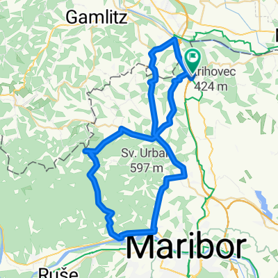
Overview
About this route
Distance:248299 Elapsed Time:0 Avg Speed: Min Altitude:0 Max Altitude:0 Climb:0 Descent:0
- -:--
- Duration
- 326.5 km
- Distance
- 4,866 m
- Ascent
- 5,135 m
- Descent
- ---
- Avg. speed
- 711 m
- Max. altitude

Route quality
Waytypes & surfaces along the route
Waytypes
Quiet road
107.7 km
(33 %)
Road
68.6 km
(21 %)
Surfaces
Paved
186.1 km
(57 %)
Unpaved
39.2 km
(12 %)
Asphalt
186.1 km
(57 %)
Gravel
32.6 km
(10 %)
Continue with Bikemap
Use, edit, or download this cycling route
You would like to ride EuroVelo 9 - Baltic - Adriatic or customize it for your own trip? Here is what you can do with this Bikemap route:
Free features
- Save this route as favorite or in collections
- Copy & plan your own version of this route
- Split it into stages to create a multi-day tour
- Sync your route with Garmin or Wahoo
Premium features
Free trial for 3 days, or one-time payment. More about Bikemap Premium.
- Navigate this route on iOS & Android
- Export a GPX / KML file of this route
- Create your custom printout (try it for free)
- Download this route for offline navigation
Discover more Premium features.
Get Bikemap PremiumFrom our community
Other popular routes starting in Šentilj
 Balkantour: Spielfeld - Korfu
- Distance
- 1,898.3 km
- Ascent
- 8,069 m
- Descent
- 8,322 m
- Location
- Šentilj, Občina Šentilj, Slovenia
 Špilje-Lipnica (Murradweg)
- Distance
- 14 km
- Ascent
- 40 m
- Descent
- 14 m
- Location
- Šentilj, Občina Šentilj, Slovenia
 Šentilj--Gaj-Kamnica-Šentilj 52km
- Distance
- 51.5 km
- Ascent
- 654 m
- Descent
- 637 m
- Location
- Šentilj, Občina Šentilj, Slovenia
 Ceršak - "Kernöl kronometer"
- Distance
- 41.7 km
- Ascent
- 57 m
- Descent
- 170 m
- Location
- Šentilj, Občina Šentilj, Slovenia
 Jantarna - pot
- Distance
- 55.3 km
- Ascent
- 218 m
- Descent
- 211 m
- Location
- Šentilj, Občina Šentilj, Slovenia
 ŠENTILJ - SPIELFELD - LANDSCHA AN DER MUR - OBERRAKITSCH - EICHFELD - GOSDORF - MURECK - TRATE - SLADKI VRH - SELNICA OB MURI - ŠENTILJ
- Distance
- 53.7 km
- Ascent
- 293 m
- Descent
- 285 m
- Location
- Šentilj, Občina Šentilj, Slovenia
 EuroVelo 9 - Baltic - Adriatic
- Distance
- 326.5 km
- Ascent
- 4,866 m
- Descent
- 5,135 m
- Location
- Šentilj, Občina Šentilj, Slovenia
 Šentilj-Svečina- Gaj nad MB- Jakob- Šentilj
- Distance
- 69.9 km
- Ascent
- 986 m
- Descent
- 988 m
- Location
- Šentilj, Občina Šentilj, Slovenia
Open it in the app