

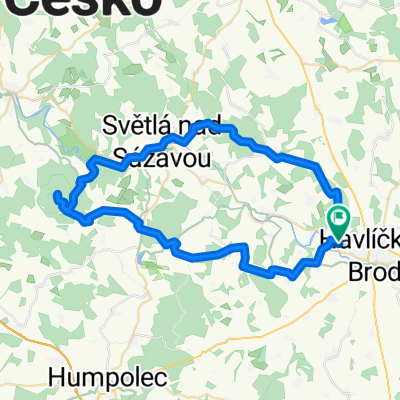
HB - Krásná Hora - Okrouhlice - Veselý Žďár
A cycling route starting in Havlíčkův Brod, Kraj Vysočina, Czechia.
Overview
About this route
The entire route on asphalt, with some terrain only in Vlkovsko.
- -:--
- Duration
- 27.5 km
- Distance
- 315 m
- Ascent
- 315 m
- Descent
- ---
- Avg. speed
- ---
- Max. altitude

Route quality
Waytypes & surfaces along the route
Waytypes
Road
16 km
(58 %)
Quiet road
3.9 km
(14 %)
Surfaces
Paved
5.2 km
(19 %)
Unpaved
3.6 km
(13 %)
Asphalt
5 km
(18 %)
Gravel
2.8 km
(10 %)
Continue with Bikemap
Use, edit, or download this cycling route
You would like to ride HB - Krásná Hora - Okrouhlice - Veselý Žďár or customize it for your own trip? Here is what you can do with this Bikemap route:
Free features
- Save this route as favorite or in collections
- Copy & plan your own version of this route
- Sync your route with Garmin or Wahoo
Premium features
Free trial for 3 days, or one-time payment. More about Bikemap Premium.
- Navigate this route on iOS & Android
- Export a GPX / KML file of this route
- Create your custom printout (try it for free)
- Download this route for offline navigation
Discover more Premium features.
Get Bikemap PremiumFrom our community
Other popular routes starting in Havlíčkův Brod
 HB - Knik - Habry - S n/S - Lipnice - KH - HB
- Distance
- 61.9 km
- Ascent
- 578 m
- Descent
- 578 m
- Location
- Havlíčkův Brod, Kraj Vysočina, Czechia
 nemecko 2012
- Distance
- 625.1 km
- Ascent
- 522 m
- Descent
- 944 m
- Location
- Havlíčkův Brod, Kraj Vysočina, Czechia
 Na Pelestrov2
- Distance
- 30.5 km
- Ascent
- 352 m
- Descent
- 352 m
- Location
- Havlíčkův Brod, Kraj Vysočina, Czechia
 slovensko 2015
- Distance
- 863.1 km
- Ascent
- 1,033 m
- Descent
- 1,339 m
- Location
- Havlíčkův Brod, Kraj Vysočina, Czechia
 Melechov 2009
- Distance
- 52.5 km
- Ascent
- 1,063 m
- Descent
- 1,041 m
- Location
- Havlíčkův Brod, Kraj Vysočina, Czechia
 HB - Krásná Hora - Okrouhlice - Veselý Žďár
- Distance
- 27.5 km
- Ascent
- 315 m
- Descent
- 315 m
- Location
- Havlíčkův Brod, Kraj Vysočina, Czechia
 110612 loudacka nanecisto podruhe
- Distance
- 133.5 km
- Ascent
- 859 m
- Descent
- 1,009 m
- Location
- Havlíčkův Brod, Kraj Vysočina, Czechia
 Výlet do Přibyslavi
- Distance
- 36.9 km
- Ascent
- 372 m
- Descent
- 372 m
- Location
- Havlíčkův Brod, Kraj Vysočina, Czechia
Open it in the app