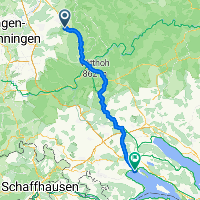
Spaichingen - Horb via FDS
A cycling route starting in Spaichingen, Baden-Wurttemberg, Germany.
Overview
About this route
From Spaichingen along the B14 to Rottweil, heading towards Villingendorf exiting Rottweil, then via Winzeln and 24 Höfe to Loßburg, there over the mountain to FDS, then to Horb
- -:--
- Duration
- 92.2 km
- Distance
- 570 m
- Ascent
- 750 m
- Descent
- ---
- Avg. speed
- ---
- Max. altitude
Continue with Bikemap
Use, edit, or download this cycling route
You would like to ride Spaichingen - Horb via FDS or customize it for your own trip? Here is what you can do with this Bikemap route:
Free features
- Save this route as favorite or in collections
- Copy & plan your own version of this route
- Split it into stages to create a multi-day tour
- Sync your route with Garmin or Wahoo
Premium features
Free trial for 3 days, or one-time payment. More about Bikemap Premium.
- Navigate this route on iOS & Android
- Export a GPX / KML file of this route
- Create your custom printout (try it for free)
- Download this route for offline navigation
Discover more Premium features.
Get Bikemap PremiumFrom our community
Other popular routes starting in Spaichingen
- Vatertag
- Distance
- 39.8 km
- Ascent
- 146 m
- Descent
- 146 m
- Location
- Spaichingen, Baden-Wurttemberg, Germany
- Alter Berg, Glatter Fels, Schrofe
- Distance
- 34.7 km
- Ascent
- 634 m
- Descent
- 632 m
- Location
- Spaichingen, Baden-Wurttemberg, Germany
- Durch den Schwarzwald nach Freiburg
- Distance
- 116.9 km
- Ascent
- 1,335 m
- Descent
- 1,723 m
- Location
- Spaichingen, Baden-Wurttemberg, Germany
- RW TR TUT SP
- Distance
- 63.1 km
- Ascent
- 376 m
- Descent
- 378 m
- Location
- Spaichingen, Baden-Wurttemberg, Germany
- Spaichingen, Konzenberg und zurück
- Distance
- 22.2 km
- Ascent
- 107 m
- Descent
- 107 m
- Location
- Spaichingen, Baden-Wurttemberg, Germany
- Spaich.-Linsenb.
- Distance
- 15.2 km
- Ascent
- 51 m
- Descent
- 133 m
- Location
- Spaichingen, Baden-Wurttemberg, Germany
- Rund Spaichingen
- Distance
- 24.4 km
- Ascent
- 216 m
- Descent
- 216 m
- Location
- Spaichingen, Baden-Wurttemberg, Germany
- Spaichingen -- Klippeneck
- Distance
- 10.4 km
- Ascent
- 426 m
- Descent
- 132 m
- Location
- Spaichingen, Baden-Wurttemberg, Germany
Open it in the app