

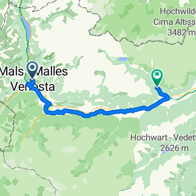
Mals-Upisee
A cycling route starting in Mals, Trentino-Alto Adige, Italy.
Overview
About this route
- -:--
- Duration
- 85.1 km
- Distance
- 2,844 m
- Ascent
- 3,246 m
- Descent
- ---
- Avg. speed
- 2,611 m
- Max. altitude

Route quality
Waytypes & surfaces along the route
Waytypes
Quiet road
31.5 km
(37 %)
Track
23 km
(27 %)
Surfaces
Paved
56.2 km
(66 %)
Unpaved
22.1 km
(26 %)
Asphalt
56.2 km
(66 %)
Unpaved (undefined)
10.2 km
(12 %)
Continue with Bikemap
Use, edit, or download this cycling route
You would like to ride Mals-Upisee or customize it for your own trip? Here is what you can do with this Bikemap route:
Free features
- Save this route as favorite or in collections
- Copy & plan your own version of this route
- Split it into stages to create a multi-day tour
- Sync your route with Garmin or Wahoo
Premium features
Free trial for 3 days, or one-time payment. More about Bikemap Premium.
- Navigate this route on iOS & Android
- Export a GPX / KML file of this route
- Create your custom printout (try it for free)
- Download this route for offline navigation
Discover more Premium features.
Get Bikemap PremiumFrom our community
Other popular routes starting in Mals
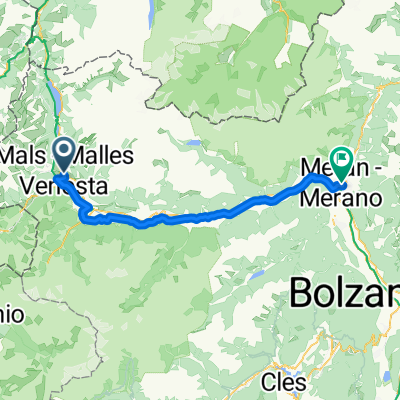
 7 July Malles Venosta to Naturns
- Distance
- 50 km
- Ascent
- 605 m
- Descent
- 809 m
- Location
- Mals, Trentino-Alto Adige, Italy
 Passo del Stelvio
- Distance
- 63.5 km
- Ascent
- 1,909 m
- Descent
- 1,909 m
- Location
- Mals, Trentino-Alto Adige, Italy
 Giro Südtirol 2011 Stage 2°
- Distance
- 158.6 km
- Ascent
- 3,071 m
- Descent
- 3,183 m
- Location
- Mals, Trentino-Alto Adige, Italy
 Von Mals bis Terlan
- Distance
- 79.5 km
- Ascent
- 266 m
- Descent
- 1,059 m
- Location
- Mals, Trentino-Alto Adige, Italy
 Bahnhofstraße, Mals nach Laubengasse, Meran
- Distance
- 63.8 km
- Ascent
- 289 m
- Descent
- 1,004 m
- Location
- Mals, Trentino-Alto Adige, Italy
 burgeis stelvio loop
- Distance
- 73.3 km
- Ascent
- 2,065 m
- Descent
- 2,065 m
- Location
- Mals, Trentino-Alto Adige, Italy
 Mals-Upisee
- Distance
- 85.1 km
- Ascent
- 2,844 m
- Descent
- 3,246 m
- Location
- Mals, Trentino-Alto Adige, Italy
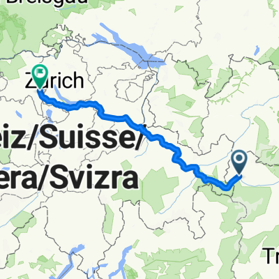 Route nach Zürich
- Distance
- 259 km
- Ascent
- 5,958 m
- Descent
- 6,597 m
- Location
- Mals, Trentino-Alto Adige, Italy
Open it in the app