

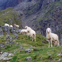
2009_08 Schober Gruppe
2009_08 Lienzer Hütte_Seichenbrunner Alm pěšky
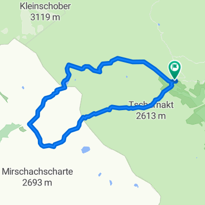
A cycling route starting in Ainet, Tyrol, Austria.
Overview
About this route
S Věrou. 23. srpna 2009. - S Věrou. 23. srpna 2009.
- -:--
- Duration
- 4.2 km
- Distance
- 20 m
- Ascent
- 297 m
- Descent
- ---
- Avg. speed
- 1,971 m
- Max. altitude

Part of
2009_08 Schober Gruppe
4 stages
Continue with Bikemap
Use, edit, or download this cycling route
You would like to ride 2009_08 Lienzer Hütte_Seichenbrunner Alm pěšky or customize it for your own trip? Here is what you can do with this Bikemap route:
Free features
- Save this route as favorite or in collections
- Copy & plan your own version of this route
- Sync your route with Garmin or Wahoo
Premium features
Free trial for 3 days, or one-time payment. More about Bikemap Premium.
- Navigate this route on iOS & Android
- Export a GPX / KML file of this route
- Create your custom printout (try it for free)
- Download this route for offline navigation
Discover more Premium features.
Get Bikemap PremiumFrom our community
Other popular routes starting in Ainet
 2009_08 Lienzer Hütte_Seichenbrunner Alm pěšky
- Distance
- 4.2 km
- Ascent
- 20 m
- Descent
- 297 m
- Location
- Ainet, Tyrol, Austria
 3_Tag_Hochschoberhütte
- Distance
- 10.2 km
- Ascent
- 1,020 m
- Descent
- 1,018 m
- Location
- Ainet, Tyrol, Austria
 Pitschedboden
- Distance
- 32.1 km
- Ascent
- 1,616 m
- Descent
- 1,613 m
- Location
- Ainet, Tyrol, Austria
 Ainet 163 nach Ainet 167
- Distance
- 26.4 km
- Ascent
- 256 m
- Descent
- 249 m
- Location
- Ainet, Tyrol, Austria
 San Candido - Ainet Austria
- Distance
- 57.9 km
- Ascent
- 567 m
- Descent
- 62 m
- Location
- Ainet, Tyrol, Austria
 bergfahrt jenny österreich
- Distance
- 29.8 km
- Ascent
- 678 m
- Descent
- 169 m
- Location
- Ainet, Tyrol, Austria
 Ainet 108b - Ainet 108b
- Distance
- 42.7 km
- Ascent
- 393 m
- Descent
- 401 m
- Location
- Ainet, Tyrol, Austria
 Drau 01 Ainet - Sachsenburg
- Distance
- 71.6 km
- Ascent
- 138 m
- Descent
- 272 m
- Location
- Ainet, Tyrol, Austria
Open it in the app