

Panorama-Tour am Albtrauf
A cycling route starting in Kohlberg, Baden-Wurttemberg, Germany.
Overview
About this route
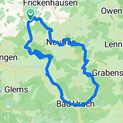
Kohlberg/Kappishäusern/Panorama Trail/Buchhalde/Urach Kaltenental/Grabenstetten Airfield/Astronomy Trail/Hohenneuffen Castle/Neuffen Vineyards/Kohlberg
- -:--
- Duration
- 32.4 km
- Distance
- 646 m
- Ascent
- 646 m
- Descent
- ---
- Avg. speed
- ---
- Max. altitude

Continue with Bikemap
Use, edit, or download this cycling route
You would like to ride Panorama-Tour am Albtrauf or customize it for your own trip? Here is what you can do with this Bikemap route:
Free features
- Save this route as favorite or in collections
- Copy & plan your own version of this route
- Sync your route with Garmin or Wahoo
Premium features
Free trial for 3 days, or one-time payment. More about Bikemap Premium.
- Navigate this route on iOS & Android
- Export a GPX / KML file of this route
- Create your custom printout (try it for free)
- Download this route for offline navigation
Discover more Premium features.
Get Bikemap PremiumFrom our community
Other popular routes starting in Kohlberg
 2 Burgen-Tour
- Distance
- 40 km
- Ascent
- 881 m
- Descent
- 882 m
- Location
- Kohlberg, Baden-Wurttemberg, Germany
 Hausrunde 1
- Distance
- 23.4 km
- Ascent
- 302 m
- Descent
- 310 m
- Location
- Kohlberg, Baden-Wurttemberg, Germany
 Besuch in Urach
- Distance
- 40 km
- Ascent
- 669 m
- Descent
- 657 m
- Location
- Kohlberg, Baden-Wurttemberg, Germany
 Oktober4
- Distance
- 69.5 km
- Ascent
- 449 m
- Descent
- 449 m
- Location
- Kohlberg, Baden-Wurttemberg, Germany
 Honau Alb
- Distance
- 64 km
- Ascent
- 568 m
- Descent
- 568 m
- Location
- Kohlberg, Baden-Wurttemberg, Germany
 Kohlberg/Panoramaweg/Urach/St.Johann/Glemser Stausee/Weinberg Metzingen/Kohlberg
- Distance
- 42.5 km
- Ascent
- 797 m
- Descent
- 797 m
- Location
- Kohlberg, Baden-Wurttemberg, Germany
 Rundtour
- Distance
- 39.9 km
- Ascent
- 629 m
- Descent
- 631 m
- Location
- Kohlberg, Baden-Wurttemberg, Germany
 Hohenneuffen -Beurener Fels
- Distance
- 30 km
- Ascent
- 510 m
- Descent
- 508 m
- Location
- Kohlberg, Baden-Wurttemberg, Germany
Open it in the app