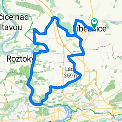
lehká trasa pro zimní najíždění km
A cycling route starting in Líbeznice, Central Bohemia, Czechia.
Overview
About this route
- -:--
- Duration
- 50 km
- Distance
- 153 m
- Ascent
- 164 m
- Descent
- ---
- Avg. speed
- 276 m
- Avg. speed
Route quality
Waytypes & surfaces along the route
Waytypes
Road
28.2 km
(56 %)
Busy road
14.4 km
(29 %)
Surfaces
Paved
25.5 km
(51 %)
Asphalt
25.3 km
(50 %)
Paving stones
0.2 km
(<1 %)
Undefined
24.6 km
(49 %)
Continue with Bikemap
Use, edit, or download this cycling route
You would like to ride lehká trasa pro zimní najíždění km or customize it for your own trip? Here is what you can do with this Bikemap route:
Free features
- Save this route as favorite or in collections
- Copy & plan your own version of this route
- Sync your route with Garmin or Wahoo
Premium features
Free trial for 3 days, or one-time payment. More about Bikemap Premium.
- Navigate this route on iOS & Android
- Export a GPX / KML file of this route
- Create your custom printout (try it for free)
- Download this route for offline navigation
Discover more Premium features.
Get Bikemap PremiumFrom our community
Other popular routes starting in Líbeznice
- VPMP_21
- Distance
- 59.5 km
- Ascent
- 109 m
- Descent
- 107 m
- Location
- Líbeznice, Central Bohemia, Czechia
- VPMP_20
- Distance
- 46.2 km
- Ascent
- 235 m
- Descent
- 235 m
- Location
- Líbeznice, Central Bohemia, Czechia
- Z Líbeznic do Roudnice
- Distance
- 66.8 km
- Ascent
- 99 m
- Descent
- 159 m
- Location
- Líbeznice, Central Bohemia, Czechia
- VPMP_25
- Distance
- 64 km
- Ascent
- 103 m
- Descent
- 103 m
- Location
- Líbeznice, Central Bohemia, Czechia
- Spící panna - časovka družstev
- Distance
- 33.5 km
- Ascent
- 151 m
- Descent
- 150 m
- Location
- Líbeznice, Central Bohemia, Czechia
- VPMP_22
- Distance
- 43.7 km
- Ascent
- 346 m
- Descent
- 346 m
- Location
- Líbeznice, Central Bohemia, Czechia
- Jarní časovka jednotlivců - Bášť
- Distance
- 6.6 km
- Ascent
- 40 m
- Descent
- 40 m
- Location
- Líbeznice, Central Bohemia, Czechia
- Koko 2
- Distance
- 141.6 km
- Ascent
- 738 m
- Descent
- 737 m
- Location
- Líbeznice, Central Bohemia, Czechia
Open it in the app