

Hinterhorn -/ Walder -/ Ganalm - Strecke
A cycling route starting in Absam, Tyrol, Austria.
Overview
About this route
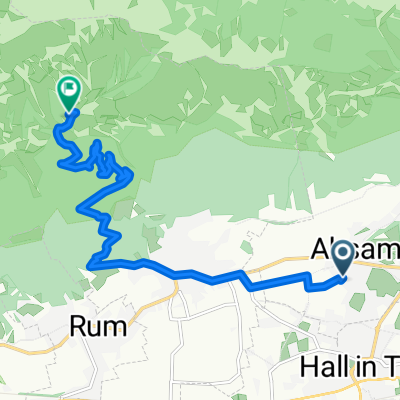
Von Absam nach Gnadenwald. Beim Speckbacherhof der Hinterhornstraße entlag und rauf auf die Hinterhornalm danach runter Richtung Walderalm und anschließend Ganalm. Von dort wieder runter nach Gnadenwald und zurück nach Absam.
- -:--
- Duration
- 30.9 km
- Distance
- 1,363 m
- Ascent
- 1,358 m
- Descent
- ---
- Avg. speed
- 1,512 m
- Avg. speed

Route quality
Waytypes & surfaces along the route
Waytypes
Quiet road
11.1 km
(36 %)
Busy road
8.7 km
(28 %)
Surfaces
Paved
17.4 km
(56 %)
Unpaved
8.7 km
(28 %)
Asphalt
17.3 km
(56 %)
Gravel
7.7 km
(25 %)
Continue with Bikemap
Use, edit, or download this cycling route
You would like to ride Hinterhorn -/ Walder -/ Ganalm - Strecke or customize it for your own trip? Here is what you can do with this Bikemap route:
Free features
- Save this route as favorite or in collections
- Copy & plan your own version of this route
- Sync your route with Garmin or Wahoo
Premium features
Free trial for 3 days, or one-time payment. More about Bikemap Premium.
- Navigate this route on iOS & Android
- Export a GPX / KML file of this route
- Create your custom printout (try it for free)
- Download this route for offline navigation
Discover more Premium features.
Get Bikemap PremiumFrom our community
Other popular routes starting in Absam
 Urlaubsfahrt
- Distance
- 59.2 km
- Ascent
- 1,384 m
- Descent
- 1,384 m
- Location
- Absam, Tyrol, Austria
 Absam - Thaurer Alm
- Distance
- 10.1 km
- Ascent
- 878 m
- Descent
- 34 m
- Location
- Absam, Tyrol, Austria
 Absam - Radfeld über Kerschbaumer Sattel
- Distance
- 52.4 km
- Ascent
- 742 m
- Descent
- 966 m
- Location
- Absam, Tyrol, Austria
 Hinterhorn -/ Walder -/ Ganalm - Strecke
- Distance
- 30.9 km
- Ascent
- 1,363 m
- Descent
- 1,358 m
- Location
- Absam, Tyrol, Austria
 Mils - Arzler Alm
- Distance
- 13.4 km
- Ascent
- 686 m
- Descent
- 366 m
- Location
- Absam, Tyrol, Austria
 Ziegelweg 11, Hall in Tirol nach Ziegelweg 13, Hall in Tirol
- Distance
- 45.5 km
- Ascent
- 620 m
- Descent
- 682 m
- Location
- Absam, Tyrol, Austria
 Hall i. Tirol - Lafatscher Joch
- Distance
- 9.2 km
- Ascent
- 1,372 m
- Descent
- 105 m
- Location
- Absam, Tyrol, Austria
 Absam - Thaurer Alm
- Distance
- 19.9 km
- Ascent
- 879 m
- Descent
- 880 m
- Location
- Absam, Tyrol, Austria
Open it in the app