Etapa 086B (Cagnes sur Mer - Villecroze)
- 143.7 km
- 2,031 m
- 1,796 m
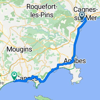
- Cagnes-sur-Mer, Provence-Alpes-Côte d'Azur Region, France
A cycling route starting in Cagnes-sur-Mer, Provence-Alpes-Côte d'Azur Region, France.
Overview
Vuelta a Europa occidental. Etapa 86 Cagnes sur Mer - Villeneuve Loubet - Antibes - Cannes - Mandelieu la Napoule - Pégomas - Auribeau-sur-Siagne - Le Tignet - Montauroux - Fayence - Seillans - Claviers - Bargemon - Callas - Draguignan - Flayosc - Lorgues - Villecroze 143.7 km 1550 m desnivel acumulado positivo
created this 3 years ago
Route quality
Quiet road
51.7 km
(36 %)
Road
17.2 km
(12 %)
Paved
84.8 km
(59 %)
Unpaved
4.3 km
(3 %)
Asphalt
80.5 km
(56 %)
Paved (undefined)
2.9 km
(2 %)
Route highlights
?¿
Hippodrome de la Côte d'Azur
Le Nomade
Musée Picasso
Rue d'Antibes
Palais des Festivals et des Congrès de Cannes
Rue Meynadier
Marché Forville
Le Château de la Napoule
Musée des Machines à écrire
Musée de l'Artillerie
Église Saint Michel
Tour de l'Horloge
Cascade de Sauveclare
Continue with Bikemap
You would like to ride Etapa 086B (Cagnes sur Mer - Villecroze) or customize it for your own trip? Here is what you can do with this Bikemap route:
Free trial for 3 days, or one-time payment. More about Bikemap Premium.
Discover more Premium features.
Get Bikemap PremiumFrom our community
Open it in the app