

amicus 52km
A cycling route starting in Ranst, Flemish Region, Belgium.
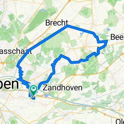
Overview
About this route
Mountainbikeroute Sint-Katelijne-Waverblauwe-groene combinatielusStartplaats Kadodderroute
- -:--
- Duration
- 51.6 km
- Distance
- 128 m
- Ascent
- 127 m
- Descent
- ---
- Avg. speed
- 11 m
- Max. altitude

Route quality
Waytypes & surfaces along the route
Waytypes
Cycleway
28.4 km
(55 %)
Quiet road
12.9 km
(25 %)
Surfaces
Paved
32 km
(62 %)
Unpaved
4.6 km
(9 %)
Asphalt
27.8 km
(54 %)
Concrete
3.6 km
(7 %)
Continue with Bikemap
Use, edit, or download this cycling route
You would like to ride amicus 52km or customize it for your own trip? Here is what you can do with this Bikemap route:
Free features
- Save this route as favorite or in collections
- Copy & plan your own version of this route
- Sync your route with Garmin or Wahoo
Premium features
Free trial for 3 days, or one-time payment. More about Bikemap Premium.
- Navigate this route on iOS & Android
- Export a GPX / KML file of this route
- Create your custom printout (try it for free)
- Download this route for offline navigation
Discover more Premium features.
Get Bikemap PremiumFrom our community
Other popular routes starting in Ranst
 in het park van Wijnegem
- Distance
- 51.1 km
- Ascent
- 84 m
- Descent
- 84 m
- Location
- Ranst, Flemish Region, Belgium
 tielen,
- Distance
- 73.2 km
- Ascent
- 68 m
- Descent
- 67 m
- Location
- Ranst, Flemish Region, Belgium
 Kikikai: Ranst-Meetkerke
- Distance
- 133.9 km
- Ascent
- 113 m
- Descent
- 115 m
- Location
- Ranst, Flemish Region, Belgium
 Millegem Zandhoven
- Distance
- 29 km
- Ascent
- 49 m
- Descent
- 51 m
- Location
- Ranst, Flemish Region, Belgium
 de 12 bruggetjes
- Distance
- 32.2 km
- Ascent
- 25 m
- Descent
- 23 m
- Location
- Ranst, Flemish Region, Belgium
 Havenroute: stabroek-Putte-Maria ter heide-Brasschaat-Schoten
- Distance
- 69.8 km
- Ascent
- 32 m
- Descent
- 35 m
- Location
- Ranst, Flemish Region, Belgium
 Schotense Vaart
- Distance
- 68.1 km
- Ascent
- 57 m
- Descent
- 60 m
- Location
- Ranst, Flemish Region, Belgium
 Toereke Johan
- Distance
- 71 km
- Ascent
- 201 m
- Descent
- 205 m
- Location
- Ranst, Flemish Region, Belgium
Open it in the app