
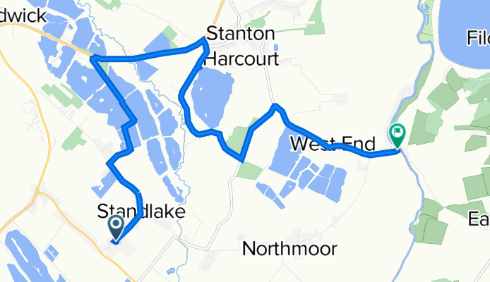
Standlake route
A cycling route starting in Ducklington, England, United Kingdom.
Overview
About this route
- -:--
- Duration
- 10.2 km
- Distance
- 9 m
- Ascent
- 13 m
- Descent
- ---
- Avg. speed
- 73 m
- Max. altitude

Continue with Bikemap
Use, edit, or download this cycling route
You would like to ride Standlake route or customize it for your own trip? Here is what you can do with this Bikemap route:
Free features
- Save this route as favorite or in collections
- Copy & plan your own version of this route
- Sync your route with Garmin or Wahoo
Premium features
Free trial for 3 days, or one-time payment. More about Bikemap Premium.
- Navigate this route on iOS & Android
- Export a GPX / KML file of this route
- Create your custom printout (try it for free)
- Download this route for offline navigation
Discover more Premium features.
Get Bikemap PremiumFrom our community
Other popular routes starting in Ducklington
 Yelford
- Distance
- 13.6 km
- Ascent
- 35 m
- Descent
- 36 m
- Location
- Ducklington, England, United Kingdom
 Home - yelford - Bampton - Home loop
- Distance
- 23.8 km
- Ascent
- 20 m
- Descent
- 20 m
- Location
- Ducklington, England, United Kingdom
 Standlake II
- Distance
- 49.1 km
- Ascent
- 109 m
- Descent
- 113 m
- Location
- Ducklington, England, United Kingdom
 Ducklington 10 km - 6,21 mile
- Distance
- 9.8 km
- Ascent
- 30 m
- Descent
- 28 m
- Location
- Ducklington, England, United Kingdom
 Standlake Start of Training
- Distance
- 55.5 km
- Ascent
- 144 m
- Descent
- 121 m
- Location
- Ducklington, England, United Kingdom
 19 Standlake Road, Witney to 43 The Willows, Witney
- Distance
- 4.5 km
- Ascent
- 7 m
- Descent
- 3 m
- Location
- Ducklington, England, United Kingdom
 Route from Croft Lane, Old Shifford, Witney
- Distance
- 38.9 km
- Ascent
- 38 m
- Descent
- 38 m
- Location
- Ducklington, England, United Kingdom
 Standlake route
- Distance
- 10.2 km
- Ascent
- 9 m
- Descent
- 13 m
- Location
- Ducklington, England, United Kingdom
Open it in the app