

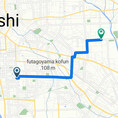
16-25, Shimmaebashimachi, Maebashi to 1321-1, Sojamachisakuragaoka, Yoshioka, Kitagunma-Gun
A cycling route starting in Maebashi, Gunma, Japan.
Overview
About this route
- 29 min
- Duration
- 7.2 km
- Distance
- 194 m
- Ascent
- 164 m
- Descent
- 14.6 km/h
- Avg. speed
- 144 m
- Max. altitude
Route quality
Waytypes & surfaces along the route
Waytypes
Cycleway
5.5 km
(77 %)
Quiet road
0.4 km
(6 %)
Surfaces
Paved
5.5 km
(76 %)
Asphalt
5.5 km
(76 %)
Undefined
1.7 km
(24 %)
Continue with Bikemap
Use, edit, or download this cycling route
You would like to ride 16-25, Shimmaebashimachi, Maebashi to 1321-1, Sojamachisakuragaoka, Yoshioka, Kitagunma-Gun or customize it for your own trip? Here is what you can do with this Bikemap route:
Free features
- Save this route as favorite or in collections
- Copy & plan your own version of this route
- Sync your route with Garmin or Wahoo
Premium features
Free trial for 3 days, or one-time payment. More about Bikemap Premium.
- Navigate this route on iOS & Android
- Export a GPX / KML file of this route
- Create your custom printout (try it for free)
- Download this route for offline navigation
Discover more Premium features.
Get Bikemap PremiumFrom our community
Other popular routes starting in Maebashi
 赤城南麓走り満喫コース
- Distance
- 73 km
- Ascent
- 1,136 m
- Descent
- 1,134 m
- Location
- Maebashi, Gunma, Japan
 1-chōme, Maebashi to FVGH+Q8, Takasaki
- Distance
- 37.7 km
- Ascent
- 1,771 m
- Descent
- 509 m
- Location
- Maebashi, Gunma, Japan
 1-chōme 2, Maebashi to Maebashi
- Distance
- 4.2 km
- Ascent
- 17 m
- Descent
- 23 m
- Location
- Maebashi, Gunma, Japan
 市街地~敷島周遊コース
- Distance
- 11.9 km
- Ascent
- 55 m
- Descent
- 56 m
- Location
- Maebashi, Gunma, Japan
 Maebashi to Sakura Riverside Park, Kumagaya
- Distance
- 56.5 km
- Ascent
- 66 m
- Descent
- 157 m
- Location
- Maebashi, Gunma, Japan
 maebashi to ikaho
- Distance
- 23.2 km
- Ascent
- 738 m
- Descent
- 82 m
- Location
- Maebashi, Gunma, Japan
 2 Chome 29, Maebashi to 1-chōme 22, Maebashi
- Distance
- 5.6 km
- Ascent
- 29 m
- Descent
- 12 m
- Location
- Maebashi, Gunma, Japan
 白井宿コース
- Distance
- 39 km
- Ascent
- 362 m
- Descent
- 358 m
- Location
- Maebashi, Gunma, Japan
Open it in the app