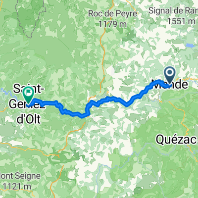
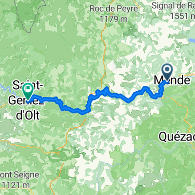
Frankreich 2022 - Cevennen - La Fage
F104-2022-La Fage/Le Fonts/Entspannen
A cycling route starting in Mende, Occitanie, France.
Overview
About this route
- -:--
- Duration
- 48.7 km
- Distance
- 768 m
- Ascent
- 770 m
- Descent
- ---
- Avg. speed
- 1,206 m
- Max. altitude
Part of
Frankreich 2022 - Cevennen - La Fage
10 stages
Route quality
Waytypes & surfaces along the route
Waytypes
Road
21.4 km
(44 %)
Quiet road
9.3 km
(19 %)
Surfaces
Paved
9.3 km
(19 %)
Asphalt
7.3 km
(15 %)
Paved (undefined)
1.9 km
(4 %)
Undefined
39.5 km
(81 %)
Continue with Bikemap
Use, edit, or download this cycling route
You would like to ride F104-2022-La Fage/Le Fonts/Entspannen or customize it for your own trip? Here is what you can do with this Bikemap route:
Free features
- Save this route as favorite or in collections
- Copy & plan your own version of this route
- Sync your route with Garmin or Wahoo
Premium features
Free trial for 3 days, or one-time payment. More about Bikemap Premium.
- Navigate this route on iOS & Android
- Export a GPX / KML file of this route
- Create your custom printout (try it for free)
- Download this route for offline navigation
Discover more Premium features.
Get Bikemap PremiumFrom our community
Other popular routes starting in Mende
- 05-X. Mende - Avignon (175 Km)
- Distance
- 175 km
- Ascent
- 2,253 m
- Descent
- 2,971 m
- Location
- Mende, Occitanie, France
- Patchwork au nord du Mont Lozère
- Distance
- 64.3 km
- Ascent
- 1,407 m
- Descent
- 1,407 m
- Location
- Mende, Occitanie, France
- Tour de France 2015 - Stage 15
- Distance
- 186.7 km
- Ascent
- 1,525 m
- Descent
- 2,118 m
- Location
- Mende, Occitanie, France
- Margeride/gorges du tarn/Mont Lozere
- Distance
- 369.5 km
- Ascent
- 3,488 m
- Descent
- 3,469 m
- Location
- Mende, Occitanie, France
- 2016 Ride Day 111 - Mende to Banassac
- Distance
- 51.7 km
- Ascent
- 792 m
- Descent
- 978 m
- Location
- Mende, Occitanie, France
- Okzitanien_Variante C
- Distance
- 674.3 km
- Ascent
- 640 m
- Descent
- 1,304 m
- Location
- Mende, Occitanie, France
- Sainte-Enimie - Valras-Plage
- Distance
- 200.3 km
- Ascent
- 1,004 m
- Descent
- 1,485 m
- Location
- Mende, Occitanie, France
- F.enV. day 1 Mende to Entraygues-sur-Truyere 120km 1800m
- Distance
- 119.4 km
- Ascent
- 930 m
- Descent
- 1,406 m
- Location
- Mende, Occitanie, France
Open it in the app