

Geumyeonsan Hike-Emart Start
A cycling route starting in Busan, Busan, South Korea.
Overview
About this route
Mixed of Paved trail and road Sidewalk. First Portion (Km's 1-2 or Mi 1) will be on paved trail which will gradually become steep and staircases. Middle portions (Km's 2.5-4 or Mi 2) will be on Pave Sidewalk along the ridgeline. Last portion will be Paved trail and staircases which will also be steep in some portions but small portions.
- -:--
- Duration
- 5.4 km
- Distance
- 433 m
- Ascent
- 397 m
- Descent
- ---
- Avg. speed
- 414 m
- Max. altitude

Route highlights
Points of interest along the route
Point of interest after 0.1 km
Malmungol Subway Station
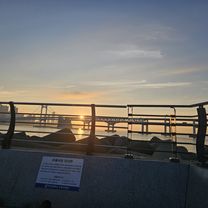
Photo after 2.3 km
Tokyo Tower Replica and Vantage/Overlook. There are restrooms and a little Souvenir Shop.
Drinking water after 3.7 km
Cafe and Restroom
Drinking water after 5.4 km
Bulgogi Street
Point of interest after 5.4 km
Guemyeonsan Subway Station
Continue with Bikemap
Use, edit, or download this cycling route
You would like to ride Geumyeonsan Hike-Emart Start or customize it for your own trip? Here is what you can do with this Bikemap route:
Free features
- Save this route as favorite or in collections
- Copy & plan your own version of this route
- Sync your route with Garmin or Wahoo
Premium features
Free trial for 3 days, or one-time payment. More about Bikemap Premium.
- Navigate this route on iOS & Android
- Export a GPX / KML file of this route
- Create your custom printout (try it for free)
- Download this route for offline navigation
Discover more Premium features.
Get Bikemap PremiumFrom our community
Other popular routes starting in Busan
 Route to Seoul Seoul-Jikhalsi
- Distance
- 517.8 km
- Ascent
- 5,249 m
- Descent
- 5,371 m
- Location
- Busan, Busan, South Korea
 World S Korea
- Distance
- 530.6 km
- Ascent
- 836 m
- Descent
- 825 m
- Location
- Busan, Busan, South Korea
 Slow ride
- Distance
- 64 km
- Ascent
- 260 m
- Descent
- 254 m
- Location
- Busan, Busan, South Korea
 Igidae Coastal Walk South
- Distance
- 4.3 km
- Ascent
- 253 m
- Descent
- 230 m
- Location
- Busan, Busan, South Korea
 사직3동 9−12 to 온천3동 1453−7
- Distance
- 17.6 km
- Ascent
- 298 m
- Descent
- 289 m
- Location
- Busan, Busan, South Korea
 Corée 30j(22b-8v)
- Distance
- 1,966.7 km
- Ascent
- 1,960 m
- Descent
- 1,945 m
- Location
- Busan, Busan, South Korea
 2025.8.11 3시45분 6시50분 집 수영강 회동저수지 입구
- Distance
- 34.4 km
- Ascent
- 121 m
- Descent
- 192 m
- Location
- Busan, Busan, South Korea
 2025.8.20
- Distance
- 20.9 km
- Ascent
- 46 m
- Descent
- 40 m
- Location
- Busan, Busan, South Korea
Open it in the app