

Etapa 100B (La Manga - Palomares)
A cycling route starting in La Manga del Mar Menor, Murcia, Spain.
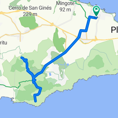
Overview
About this route
Vuelta a Europa occidental. Etapa 100
La Manga - Los Belones - Portman - Alumbres - Cartagena - Canteras - Perín - Casas de Tallante - Puerto de Mazarrón - Bolnuevo - Puntas de Calnegre - Los Curas - Calabardina - Los Geraneos - Águilas - Calarreona - San Juan de los Terreros - Villaricos - Palomares
152.2 km
1610 m desnivel positivo acumulado
- -:--
- Duration
- 152.2 km
- Distance
- 1,951 m
- Ascent
- 1,957 m
- Descent
- ---
- Avg. speed
- 389 m
- Max. altitude

Route quality
Waytypes & surfaces along the route
Waytypes
Busy road
37 km
(24 %)
Cycleway
33.7 km
(22 %)
Surfaces
Paved
98.6 km
(65 %)
Unpaved
8.9 km
(6 %)
Asphalt
91.8 km
(60 %)
Gravel
7.1 km
(5 %)
Route highlights
Points of interest along the route
Point of interest after 29.8 km
El Zulo
Point of interest after 29.9 km
Museo Naval de Cartagena
Point of interest after 30.2 km
Plaza Ayuntamiento
Point of interest after 30.3 km
Teatro Romano de Cartagena
Point of interest after 31.5 km
Museo Histórico Militar de Cartagena
Point of interest after 75.4 km
Gredas de Bolnuevo
Point of interest after 122.4 km
Plaza de España
Continue with Bikemap
Use, edit, or download this cycling route
You would like to ride Etapa 100B (La Manga - Palomares) or customize it for your own trip? Here is what you can do with this Bikemap route:
Free features
- Save this route as favorite or in collections
- Copy & plan your own version of this route
- Split it into stages to create a multi-day tour
- Sync your route with Garmin or Wahoo
Premium features
Free trial for 3 days, or one-time payment. More about Bikemap Premium.
- Navigate this route on iOS & Android
- Export a GPX / KML file of this route
- Create your custom printout (try it for free)
- Download this route for offline navigation
Discover more Premium features.
Get Bikemap PremiumFrom our community
Other popular routes starting in La Manga del Mar Menor
 Mar de Cristal-Cenizas
- Distance
- 16.2 km
- Ascent
- 391 m
- Descent
- 140 m
- Location
- La Manga del Mar Menor, Murcia, Spain
 Calblanque
- Distance
- 56.1 km
- Ascent
- 634 m
- Descent
- 633 m
- Location
- La Manga del Mar Menor, Murcia, Spain
 Ciclot. La Unión
- Distance
- 43.3 km
- Ascent
- 400 m
- Descent
- 400 m
- Location
- La Manga del Mar Menor, Murcia, Spain
 Por fin....Calblanqie...!!!!
- Distance
- 35.9 km
- Ascent
- 2,064 m
- Descent
- 2,080 m
- Location
- La Manga del Mar Menor, Murcia, Spain
 Cala del pino
- Distance
- 11.1 km
- Ascent
- 401 m
- Descent
- 415 m
- Location
- La Manga del Mar Menor, Murcia, Spain
 La Manga to Los Nietos
- Distance
- 22.2 km
- Ascent
- 335 m
- Descent
- 373 m
- Location
- La Manga del Mar Menor, Murcia, Spain
 mar de cristal-peña del aguila-cenizas-mar de cristal
- Distance
- 26 km
- Ascent
- 449 m
- Descent
- 449 m
- Location
- La Manga del Mar Menor, Murcia, Spain
 mar de cristal salinas calblanke mar de cristal
- Distance
- 21.6 km
- Ascent
- 159 m
- Descent
- 156 m
- Location
- La Manga del Mar Menor, Murcia, Spain
Open it in the app