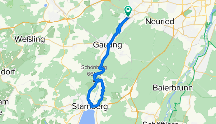
Würmtal-Krailling-Starnberg
A cycling route starting in Planegg, Bavaria, Germany.
Overview
About this route
- -:--
- Duration
- 30.4 km
- Distance
- 214 m
- Ascent
- 213 m
- Descent
- ---
- Avg. speed
- 615 m
- Avg. speed
Route photos
Route quality
Waytypes & surfaces along the route
Waytypes
Quiet road
11.5 km
(38 %)
Track
10.2 km
(34 %)
Surfaces
Paved
20.8 km
(69 %)
Unpaved
8.9 km
(29 %)
Asphalt
20.4 km
(67 %)
Pebblestone
2.9 km
(9 %)
Continue with Bikemap
Use, edit, or download this cycling route
You would like to ride Würmtal-Krailling-Starnberg or customize it for your own trip? Here is what you can do with this Bikemap route:
Free features
- Save this route as favorite or in collections
- Copy & plan your own version of this route
- Sync your route with Garmin or Wahoo
Premium features
Free trial for 3 days, or one-time payment. More about Bikemap Premium.
- Navigate this route on iOS & Android
- Export a GPX / KML file of this route
- Create your custom printout (try it for free)
- Download this route for offline navigation
Discover more Premium features.
Get Bikemap PremiumFrom our community
Other popular routes starting in Planegg
- Krailling - Germeringer See by Kovi
- Distance
- 8.8 km
- Ascent
- 9 m
- Descent
- 21 m
- Location
- Planegg, Bavaria, Germany
- Krailling nach Breitbrunn am Ammersee CLONED FROM ROUTE 41571
- Distance
- 28.4 km
- Ascent
- 241 m
- Descent
- 250 m
- Location
- Planegg, Bavaria, Germany
- Vom Wallfahrtskirchlein Maria Eich zum Maibaumdorf Unterbrunn
- Distance
- 22.3 km
- Ascent
- 69 m
- Descent
- 70 m
- Location
- Planegg, Bavaria, Germany
- 20160430 Gilching und Leutstetten
- Distance
- 76.3 km
- Ascent
- 179 m
- Descent
- 178 m
- Location
- Planegg, Bavaria, Germany
- S6 Planegg Rund um den Starnberger See
- Distance
- 79.4 km
- Ascent
- 241 m
- Descent
- 239 m
- Location
- Planegg, Bavaria, Germany
- Planegg FT
- Distance
- 15.3 km
- Ascent
- 1,576 m
- Descent
- 1,581 m
- Location
- Planegg, Bavaria, Germany
- Krailling Isar
- Distance
- 41 km
- Ascent
- 238 m
- Descent
- 236 m
- Location
- Planegg, Bavaria, Germany
- Krailling - Buchenhain - Isar - Gauting
- Distance
- 41.6 km
- Ascent
- 305 m
- Descent
- 304 m
- Location
- Planegg, Bavaria, Germany
Open it in the app