

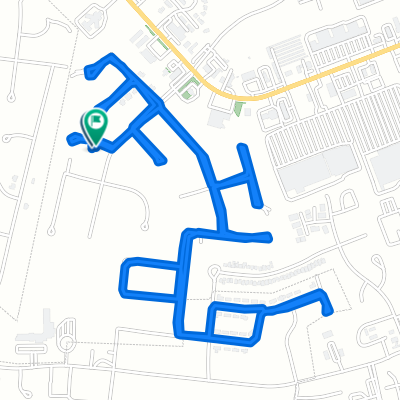
2916 Gunsmoke Trail Way, Bowling Green to 2904 Gunsmoke Trail Way, Bowling Green
A cycling route starting in Bowling Green, Kentucky, United States.
Overview
About this route
- 57 min
- Duration
- 23.1 km
- Distance
- 269 m
- Ascent
- 276 m
- Descent
- 24.3 km/h
- Avg. speed
- 233 m
- Max. altitude
Route quality
Waytypes & surfaces along the route
Waytypes
Quiet road
15.4 km
(67 %)
Road
6.2 km
(27 %)
Undefined
1.4 km
(6 %)
Continue with Bikemap
Use, edit, or download this cycling route
You would like to ride 2916 Gunsmoke Trail Way, Bowling Green to 2904 Gunsmoke Trail Way, Bowling Green or customize it for your own trip? Here is what you can do with this Bikemap route:
Free features
- Save this route as favorite or in collections
- Copy & plan your own version of this route
- Sync your route with Garmin or Wahoo
Premium features
Free trial for 3 days, or one-time payment. More about Bikemap Premium.
- Navigate this route on iOS & Android
- Export a GPX / KML file of this route
- Create your custom printout (try it for free)
- Download this route for offline navigation
Discover more Premium features.
Get Bikemap PremiumFrom our community
Other popular routes starting in Bowling Green
 1601–1799 Bent Tree Ave, Bowling Green to 1539 Euclid Ave, Bowling Green
- Distance
- 0.3 km
- Ascent
- 0 m
- Descent
- 0 m
- Location
- Bowling Green, Kentucky, United States
 1483 Woods End Cove Ct, Bowling Green to 1483 Woods End Cove Ct, Bowling Green
- Distance
- 7.3 km
- Ascent
- 36 m
- Descent
- 35 m
- Location
- Bowling Green, Kentucky, United States
 275 Lost River Ln, Bowling Green to 281 Lost River Ln, Bowling Green
- Distance
- 4.1 km
- Ascent
- 29 m
- Descent
- 90 m
- Location
- Bowling Green, Kentucky, United States
 College Street 1319, Bowling Green to College Street 1311, Bowling Green
- Distance
- 26.1 km
- Ascent
- 102 m
- Descent
- 103 m
- Location
- Bowling Green, Kentucky, United States
 Steady ride in Bowling Green
- Distance
- 16.5 km
- Ascent
- 45 m
- Descent
- 43 m
- Location
- Bowling Green, Kentucky, United States
 coast
coast- Distance
- 673.6 km
- Ascent
- 4,451 m
- Descent
- 4,401 m
- Location
- Bowling Green, Kentucky, United States
 Restful route in Bowling Green
- Distance
- 20.3 km
- Ascent
- 149 m
- Descent
- 137 m
- Location
- Bowling Green, Kentucky, United States
 Park Street 1438, Bowling Green to Nashville Road 2430, Bowling Green
- Distance
- 4.2 km
- Ascent
- 27 m
- Descent
- 45 m
- Location
- Bowling Green, Kentucky, United States
Open it in the app