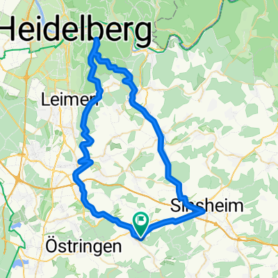
Hoffenheim-Eppingen-Waldangelloch
A cycling route starting in Balzfeld, Baden-Württemberg, Germany.
Overview
About this route
- -:--
- Duration
- 45.3 km
- Distance
- 243 m
- Ascent
- 243 m
- Descent
- ---
- Avg. speed
- ---
- Avg. speed
Route quality
Waytypes & surfaces along the route
Waytypes
Busy road
28.7 km
(63 %)
Road
7.3 km
(16 %)
Surfaces
Paved
42.7 km
(94 %)
Asphalt
41.9 km
(92 %)
Paved (undefined)
0.8 km
(2 %)
Continue with Bikemap
Use, edit, or download this cycling route
You would like to ride Hoffenheim-Eppingen-Waldangelloch or customize it for your own trip? Here is what you can do with this Bikemap route:
Free features
- Save this route as favorite or in collections
- Copy & plan your own version of this route
- Sync your route with Garmin or Wahoo
Premium features
Free trial for 3 days, or one-time payment. More about Bikemap Premium.
- Navigate this route on iOS & Android
- Export a GPX / KML file of this route
- Create your custom printout (try it for free)
- Download this route for offline navigation
Discover more Premium features.
Get Bikemap PremiumFrom our community
Other popular routes starting in Balzfeld
- Königsstuhl Anlauf
- Distance
- 31.8 km
- Ascent
- 350 m
- Descent
- 365 m
- Location
- Balzfeld, Baden-Württemberg, Germany
- Hoffenheim-Eppingen-Waldangelloch
- Distance
- 45.3 km
- Ascent
- 243 m
- Descent
- 243 m
- Location
- Balzfeld, Baden-Württemberg, Germany
- Hoffe - Horrenberg - Lingenthal - Bammental - Hoffe
- Distance
- 44.9 km
- Ascent
- 535 m
- Descent
- 535 m
- Location
- Balzfeld, Baden-Württemberg, Germany
- Feierabendrunde Angelbachtal 2
- Distance
- 21.1 km
- Ascent
- 174 m
- Descent
- 174 m
- Location
- Balzfeld, Baden-Württemberg, Germany
- Die kleine Runde zwischendurch
- Distance
- 28.6 km
- Ascent
- 303 m
- Descent
- 335 m
- Location
- Balzfeld, Baden-Württemberg, Germany
- Hoffe - Dühren - Hoffe
- Distance
- 22.9 km
- Ascent
- 407 m
- Descent
- 406 m
- Location
- Balzfeld, Baden-Württemberg, Germany
- Königsstuhl
- Distance
- 49.7 km
- Ascent
- 1,006 m
- Descent
- 916 m
- Location
- Balzfeld, Baden-Württemberg, Germany
- Angelbachtal Königsstuhl und zurück
- Distance
- 62.9 km
- Ascent
- 549 m
- Descent
- 550 m
- Location
- Balzfeld, Baden-Württemberg, Germany
Open it in the app