

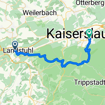
Kaiserstraße 54A, Landstuhl nach Hauptstraße 111–115, Reichenbach-Steegen
A cycling route starting in Landstuhl, Rhineland-Palatinate, Germany.
Overview
About this route
- 58 min
- Duration
- 14.1 km
- Distance
- 174 m
- Ascent
- 148 m
- Descent
- 14.6 km/h
- Avg. speed
- 335 m
- Max. altitude
Route quality
Waytypes & surfaces along the route
Waytypes
Busy road
6.7 km
(48 %)
Quiet road
2.3 km
(16 %)
Surfaces
Paved
12.3 km
(87 %)
Unpaved
1.1 km
(8 %)
Asphalt
11.6 km
(83 %)
Ground
0.7 km
(5 %)
Continue with Bikemap
Use, edit, or download this cycling route
You would like to ride Kaiserstraße 54A, Landstuhl nach Hauptstraße 111–115, Reichenbach-Steegen or customize it for your own trip? Here is what you can do with this Bikemap route:
Free features
- Save this route as favorite or in collections
- Copy & plan your own version of this route
- Sync your route with Garmin or Wahoo
Premium features
Free trial for 3 days, or one-time payment. More about Bikemap Premium.
- Navigate this route on iOS & Android
- Export a GPX / KML file of this route
- Create your custom printout (try it for free)
- Download this route for offline navigation
Discover more Premium features.
Get Bikemap PremiumFrom our community
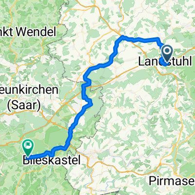
Other popular routes starting in Landstuhl
 Brief bike tour through Landstuhl
- Distance
- 0.9 km
- Ascent
- 25 m
- Descent
- 9 m
- Location
- Landstuhl, Rhineland-Palatinate, Germany
 Radsport Wolf Permanente 2010 - 75 km Perm. des RSC 1950 Kaiserslautern e.V.
- Distance
- 73.9 km
- Ascent
- 528 m
- Descent
- 528 m
- Location
- Landstuhl, Rhineland-Palatinate, Germany
 Rund um die Täler
- Distance
- 27.4 km
- Ascent
- 376 m
- Descent
- 386 m
- Location
- Landstuhl, Rhineland-Palatinate, Germany
 Landstuhl-Gelterswoog
- Distance
- 13.5 km
- Ascent
- 277 m
- Descent
- 222 m
- Location
- Landstuhl, Rhineland-Palatinate, Germany
 Burg-Nanstein-Weg
- Distance
- 12.8 km
- Ascent
- 339 m
- Descent
- 336 m
- Location
- Landstuhl, Rhineland-Palatinate, Germany
 2009.2 Beta Lustiger Potzberg
- Distance
- 45.9 km
- Ascent
- 723 m
- Descent
- 747 m
- Location
- Landstuhl, Rhineland-Palatinate, Germany
 Landstuhl Ride 1
- Distance
- 33.9 km
- Ascent
- 304 m
- Descent
- 305 m
- Location
- Landstuhl, Rhineland-Palatinate, Germany
 130825 DIaRad 2013 Tag 2
- Distance
- 57.7 km
- Ascent
- 171 m
- Descent
- 185 m
- Location
- Landstuhl, Rhineland-Palatinate, Germany
Open it in the app