

Idee Steinbergtrophy_2022_neu
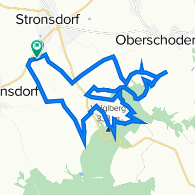
A cycling route starting in Stronsdorf, Lower Austria, Austria.
Overview
About this route
- -:--
- Duration
- 16.6 km
- Distance
- 432 m
- Ascent
- 430 m
- Descent
- ---
- Avg. speed
- 367 m
- Max. altitude

Route quality
Waytypes & surfaces along the route
Waytypes
Track
14.6 km
(88 %)
Quiet road
0.5 km
(3 %)
Surfaces
Paved
3 km
(18 %)
Unpaved
12.3 km
(74 %)
Ground
9.3 km
(56 %)
Paved (undefined)
2 km
(12 %)
Continue with Bikemap
Use, edit, or download this cycling route
You would like to ride Idee Steinbergtrophy_2022_neu or customize it for your own trip? Here is what you can do with this Bikemap route:
Free features
- Save this route as favorite or in collections
- Copy & plan your own version of this route
- Sync your route with Garmin or Wahoo
Premium features
Free trial for 3 days, or one-time payment. More about Bikemap Premium.
- Navigate this route on iOS & Android
- Export a GPX / KML file of this route
- Create your custom printout (try it for free)
- Download this route for offline navigation
Discover more Premium features.
Get Bikemap PremiumFrom our community
Other popular routes starting in Stronsdorf
 Idee Steinbergtrophy_2022_neu
- Distance
- 16.6 km
- Ascent
- 432 m
- Descent
- 430 m
- Location
- Stronsdorf, Lower Austria, Austria
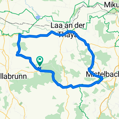
 Sitzendorf a.d. Schmida Runde
- Distance
- 63 km
- Ascent
- 374 m
- Descent
- 374 m
- Location
- Stronsdorf, Lower Austria, Austria
 Egenburg-Pulkau Retz
- Distance
- 92.4 km
- Ascent
- 353 m
- Descent
- 354 m
- Location
- Stronsdorf, Lower Austria, Austria
 Buschberg 2
- Distance
- 30.8 km
- Ascent
- 415 m
- Descent
- 415 m
- Location
- Stronsdorf, Lower Austria, Austria
 Idee Steinbergtrophy
- Distance
- 13.6 km
- Ascent
- 399 m
- Descent
- 397 m
- Location
- Stronsdorf, Lower Austria, Austria
 Radwantertag 2022_Idee lang
- Distance
- 48.7 km
- Ascent
- 379 m
- Descent
- 380 m
- Location
- Stronsdorf, Lower Austria, Austria
 Steinberg Lauf_kleine Runde
- Distance
- 6.3 km
- Ascent
- 110 m
- Descent
- 107 m
- Location
- Stronsdorf, Lower Austria, Austria
 Mistelbach-Laa-Immendorf
- Distance
- 101.1 km
- Ascent
- 373 m
- Descent
- 373 m
- Location
- Stronsdorf, Lower Austria, Austria
Open it in the app