

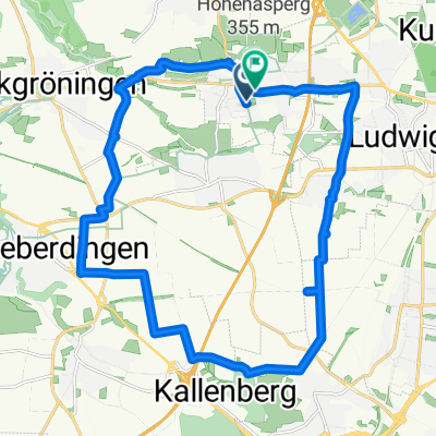
4/28 Asperg to Weinsberg
A cycling route starting in Asperg, Baden-Wurttemberg, Germany.
Overview
About this route
Asperg to Weinsberg along Necker River.
- -:--
- Duration
- 46 km
- Distance
- 350 m
- Ascent
- 420 m
- Descent
- ---
- Avg. speed
- 278 m
- Max. altitude

Route quality
Waytypes & surfaces along the route
Waytypes
Track
17 km
(37 %)
Quiet road
10.1 km
(22 %)
Surfaces
Paved
43.3 km
(94 %)
Unpaved
0.5 km
(1 %)
Asphalt
43.3 km
(94 %)
Gravel
0.5 km
(1 %)
Undefined
2.3 km
(5 %)
Continue with Bikemap
Use, edit, or download this cycling route
You would like to ride 4/28 Asperg to Weinsberg or customize it for your own trip? Here is what you can do with this Bikemap route:
Free features
- Save this route as favorite or in collections
- Copy & plan your own version of this route
- Sync your route with Garmin or Wahoo
Premium features
Free trial for 3 days, or one-time payment. More about Bikemap Premium.
- Navigate this route on iOS & Android
- Export a GPX / KML file of this route
- Create your custom printout (try it for free)
- Download this route for offline navigation
Discover more Premium features.
Get Bikemap PremiumFrom our community
Other popular routes starting in Asperg
 Neckar-Schozach-Bottwartal
- Distance
- 111.2 km
- Ascent
- 334 m
- Descent
- 334 m
- Location
- Asperg, Baden-Wurttemberg, Germany
 Kurze Runde um denHohen Asperg
- Distance
- 25.7 km
- Ascent
- 204 m
- Descent
- 204 m
- Location
- Asperg, Baden-Wurttemberg, Germany
 asperg-lemberg
- Distance
- 39.3 km
- Ascent
- 497 m
- Descent
- 473 m
- Location
- Asperg, Baden-Wurttemberg, Germany
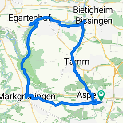
 Asperg und Markgröningen
- Distance
- 23.2 km
- Ascent
- 229 m
- Descent
- 235 m
- Location
- Asperg, Baden-Wurttemberg, Germany
 4/28 Asperg to Weinsberg
- Distance
- 46 km
- Ascent
- 350 m
- Descent
- 420 m
- Location
- Asperg, Baden-Wurttemberg, Germany
 Keltenweg - Glems - Enz Tor
- Distance
- 42.7 km
- Ascent
- 297 m
- Descent
- 296 m
- Location
- Asperg, Baden-Wurttemberg, Germany
 Bietigheim
- Distance
- 22.6 km
- Ascent
- 285 m
- Descent
- 285 m
- Location
- Asperg, Baden-Wurttemberg, Germany
 Tamm
Tamm- Distance
- 13.1 km
- Ascent
- 99 m
- Descent
- 99 m
- Location
- Asperg, Baden-Wurttemberg, Germany
Open it in the app