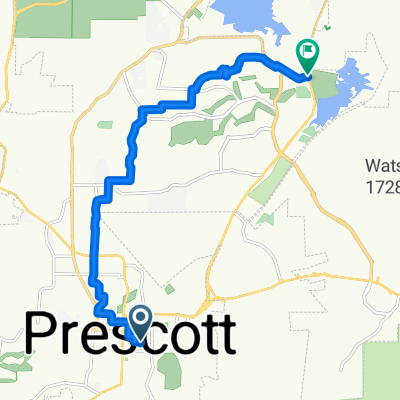
1828 W Farview Ln, Prescott to 1824 W Farview Ln, Prescott
A cycling route starting in Prescott, Arizona, United States of America.
Overview
About this route
- 2 h 51 min
- Duration
- 31.7 km
- Distance
- 746 m
- Ascent
- 739 m
- Descent
- 11.1 km/h
- Avg. speed
- 2,127 m
- Avg. speed
Route quality
Waytypes & surfaces along the route
Waytypes
Quiet road
25.1 km
(79 %)
Road
6.2 km
(20 %)
Surfaces
Paved
5.9 km
(19 %)
Unpaved
12.9 km
(41 %)
Unpaved (undefined)
7.8 km
(25 %)
Gravel
5.1 km
(16 %)
Continue with Bikemap
Use, edit, or download this cycling route
You would like to ride 1828 W Farview Ln, Prescott to 1824 W Farview Ln, Prescott or customize it for your own trip? Here is what you can do with this Bikemap route:
Free features
- Save this route as favorite or in collections
- Copy & plan your own version of this route
- Sync your route with Garmin or Wahoo
Premium features
Free trial for 3 days, or one-time payment. More about Bikemap Premium.
- Navigate this route on iOS & Android
- Export a GPX / KML file of this route
- Create your custom printout (try it for free)
- Download this route for offline navigation
Discover more Premium features.
Get Bikemap PremiumFrom our community
Other popular routes starting in Prescott
- Thumb Butte, sunset lookout loop
- Distance
- 22.7 km
- Ascent
- 449 m
- Descent
- 449 m
- Location
- Prescott, Arizona, United States of America
- Recovered Route
- Distance
- 82 km
- Ascent
- 2,496 m
- Descent
- 2,450 m
- Location
- Prescott, Arizona, United States of America
- Day 27 CLONED FROM ROUTE 955359
- Distance
- 216.6 km
- Ascent
- 619 m
- Descent
- 1,985 m
- Location
- Prescott, Arizona, United States of America
- 1828 W Farview Ln, Prescott to 1824 W Farview Ln, Prescott
- Distance
- 31.7 km
- Ascent
- 746 m
- Descent
- 739 m
- Location
- Prescott, Arizona, United States of America
- 516 Frederick Ln, Prescott to Quail Loop, Cottonwood
- Distance
- 72.2 km
- Ascent
- 1,024 m
- Descent
- 1,689 m
- Location
- Prescott, Arizona, United States of America
- TS07-TS08
- Distance
- 87.6 km
- Ascent
- 726 m
- Descent
- 1,428 m
- Location
- Prescott, Arizona, United States of America
- Skull Valley Loop
- Distance
- 84.9 km
- Ascent
- 1,019 m
- Descent
- 1,012 m
- Location
- Prescott, Arizona, United States of America
- Cielo Circle 781, Prescott to Willow Creek Road 3500, Prescott
- Distance
- 15.1 km
- Ascent
- 110 m
- Descent
- 302 m
- Location
- Prescott, Arizona, United States of America
Open it in the app